You are here: Home > Network List > TA - USArray Transportable Network (new EarthScope stations) Stations List
> Station J20K Nowitna River, AK, USA > Earthquake Result Viewer
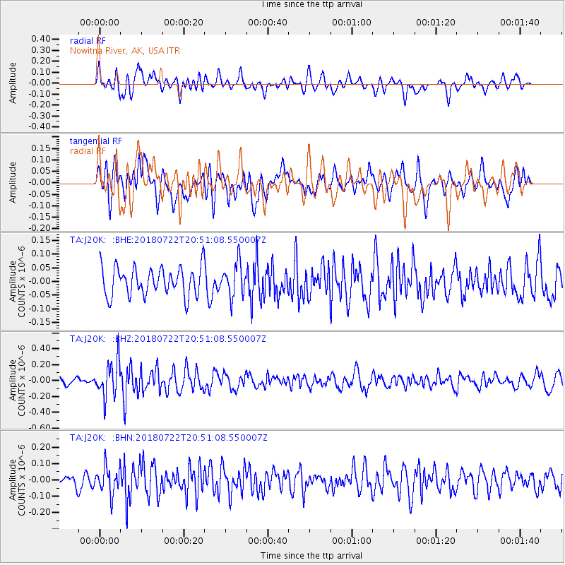
J20K Nowitna River, AK, USA - Earthquake Result Viewer
*The percent match for this event was below the threshold and hence no stack was calculated.
| Earthquake location: |
Northern And Central Iran |
| Earthquake latitude/longitude: |
30.4/57.4 |
| Earthquake time(UTC): |
2018/07/22 (203) 20:39:17 GMT |
| Earthquake Depth: |
10 km |
| Earthquake Magnitude: |
5.5 Mww |
| Earthquake Catalog/Contributor: |
NEIC PDE/us |
|
| Network: |
TA USArray Transportable Network (new EarthScope stations) |
| Station: |
J20K Nowitna River, AK, USA |
| Lat/Lon: |
64.18 N/154.15 W |
| Elevation: |
314 m |
|
| Distance: |
82.5 deg |
| Az: |
13.374 deg |
| Baz: |
332.857 deg |
| Ray Param: |
$rayparam |
*The percent match for this event was below the threshold and hence was not used in the summary stack. |
|
| Radial Match: |
60.800953 % |
| Radial Bump: |
400 |
| Transverse Match: |
56.990284 % |
| Transverse Bump: |
400 |
| SOD ConfigId: |
13570011 |
| Insert Time: |
2019-04-30 15:32:28.160 +0000 |
| GWidth: |
2.5 |
| Max Bumps: |
400 |
| Tol: |
0.001 |
|
Signal To Noise
| Channel | StoN | STA | LTA |
| TA:J20K: :BHZ:20180722T20:51:08.550007Z | 3.5073965 | 2.2533527E-7 | 6.424574E-8 |
| TA:J20K: :BHN:20180722T20:51:08.550007Z | 1.973753 | 8.5069445E-8 | 4.3100354E-8 |
| TA:J20K: :BHE:20180722T20:51:08.550007Z | 1.1812904 | 6.11671E-8 | 5.1779903E-8 |
| Arrivals |
| Ps | |
| PpPs | |
| PsPs/PpSs | |


