You are here: Home > Network List > TA - USArray Transportable Network (new EarthScope stations) Stations List
> Station J26L Joseph Creek, AK, USA > Earthquake Result Viewer
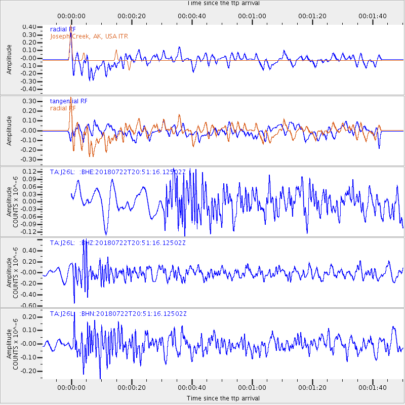
J26L Joseph Creek, AK, USA - Earthquake Result Viewer
*The percent match for this event was below the threshold and hence no stack was calculated.
| Earthquake location: |
Northern And Central Iran |
| Earthquake latitude/longitude: |
30.4/57.4 |
| Earthquake time(UTC): |
2018/07/22 (203) 20:39:17 GMT |
| Earthquake Depth: |
10 km |
| Earthquake Magnitude: |
5.5 Mww |
| Earthquake Catalog/Contributor: |
NEIC PDE/us |
|
| Network: |
TA USArray Transportable Network (new EarthScope stations) |
| Station: |
J26L Joseph Creek, AK, USA |
| Lat/Lon: |
64.50 N/143.56 W |
| Elevation: |
1144 m |
|
| Distance: |
84.0 deg |
| Az: |
8.97 deg |
| Baz: |
341.87 deg |
| Ray Param: |
$rayparam |
*The percent match for this event was below the threshold and hence was not used in the summary stack. |
|
| Radial Match: |
54.819176 % |
| Radial Bump: |
400 |
| Transverse Match: |
45.625156 % |
| Transverse Bump: |
400 |
| SOD ConfigId: |
13570011 |
| Insert Time: |
2019-04-30 15:32:35.350 +0000 |
| GWidth: |
2.5 |
| Max Bumps: |
400 |
| Tol: |
0.001 |
|
Signal To Noise
| Channel | StoN | STA | LTA |
| TA:J26L: :BHZ:20180722T20:51:16.12502Z | 6.0412183 | 2.3230604E-7 | 3.8453507E-8 |
| TA:J26L: :BHN:20180722T20:51:16.12502Z | 1.9913344 | 8.4596856E-8 | 4.2482498E-8 |
| TA:J26L: :BHE:20180722T20:51:16.12502Z | 1.3352478 | 5.982175E-8 | 4.480199E-8 |
| Arrivals |
| Ps | |
| PpPs | |
| PsPs/PpSs | |


