You are here: Home > Network List > PF - Volcanologic Network of Piton de Fournaise-OVPF Stations List
> Station BON Bory Nord > Earthquake Result Viewer
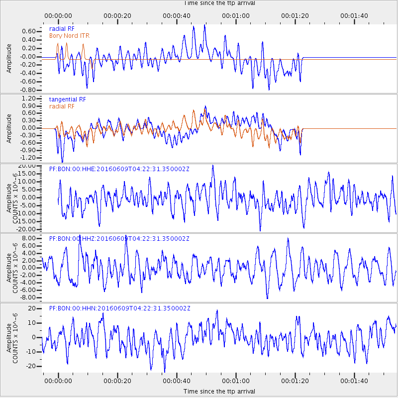
BON Bory Nord - Earthquake Result Viewer
*The percent match for this event was below the threshold and hence no stack was calculated.
| Earthquake location: |
South Of Sumbawa, Indonesia |
| Earthquake latitude/longitude: |
-11.5/116.2 |
| Earthquake time(UTC): |
2016/06/09 (161) 04:13:08 GMT |
| Earthquake Depth: |
30 km |
| Earthquake Magnitude: |
6.2 MWP |
| Earthquake Catalog/Contributor: |
NEIC PDE/NEIC COMCAT |
|
| Network: |
PF Volcanologic Network of Piton de Fournaise-OVPF |
| Station: |
BON Bory Nord |
| Lat/Lon: |
21.24 S/55.71 E |
| Elevation: |
2552 m |
|
| Distance: |
58.6 deg |
| Az: |
252.095 deg |
| Baz: |
90.707 deg |
| Ray Param: |
$rayparam |
*The percent match for this event was below the threshold and hence was not used in the summary stack. |
|
| Radial Match: |
45.123386 % |
| Radial Bump: |
400 |
| Transverse Match: |
39.62782 % |
| Transverse Bump: |
400 |
| SOD ConfigId: |
1609551 |
| Insert Time: |
2016-06-23 04:14:19.415 +0000 |
| GWidth: |
2.5 |
| Max Bumps: |
400 |
| Tol: |
0.001 |
|
Signal To Noise
| Channel | StoN | STA | LTA |
| PF:BON:00:HHZ:20160609T04:22:31.350002Z | 1.388601 | 3.3199485E-6 | 2.3908588E-6 |
| PF:BON:00:HHN:20160609T04:22:31.350002Z | 1.1330961 | 8.88608E-6 | 7.8423E-6 |
| PF:BON:00:HHE:20160609T04:22:31.350002Z | 0.94661206 | 5.4752845E-6 | 5.784085E-6 |
| Arrivals |
| Ps | |
| PpPs | |
| PsPs/PpSs | |


