You are here: Home > Network List > BK - Berkeley Digital Seismograph Network Stations List
> Station HUMO Hull Mountain, OR > Earthquake Result Viewer
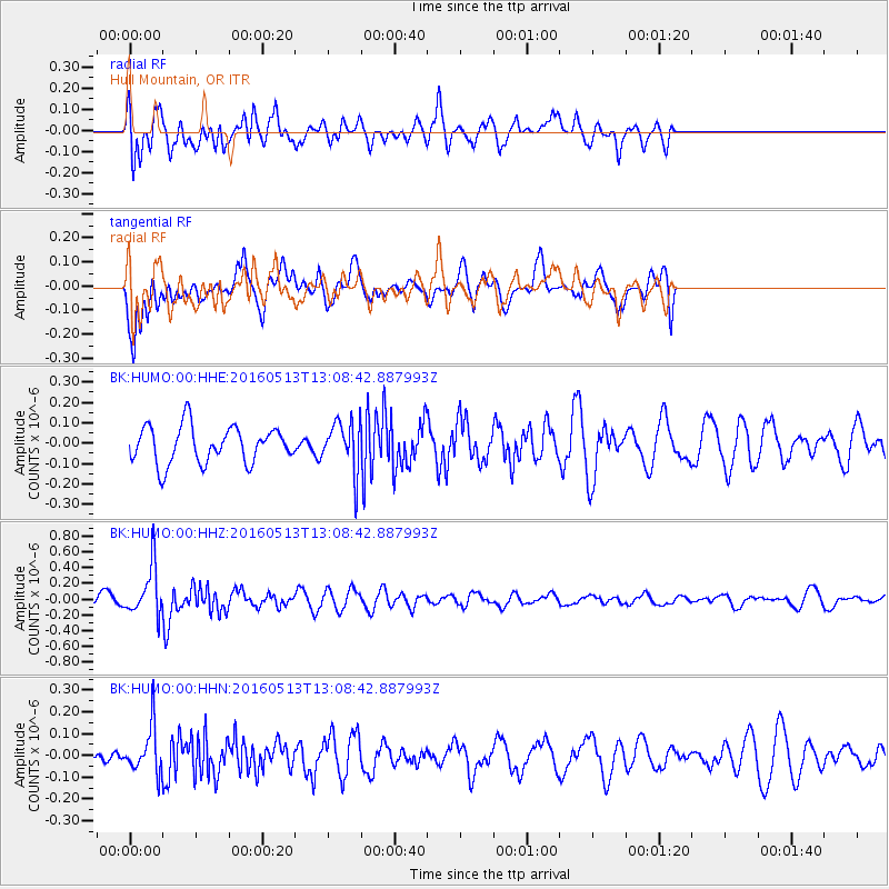
HUMO Hull Mountain, OR - Earthquake Result Viewer
*The percent match for this event was below the threshold and hence no stack was calculated.
| Earthquake location: |
South Of Fiji Islands |
| Earthquake latitude/longitude: |
-25.5/179.3 |
| Earthquake time(UTC): |
2016/05/13 (134) 12:57:27 GMT |
| Earthquake Depth: |
506 km |
| Earthquake Magnitude: |
5.6 MWW |
| Earthquake Catalog/Contributor: |
NEIC PDE/NEIC COMCAT |
|
| Network: |
BK Berkeley Digital Seismograph Network |
| Station: |
HUMO Hull Mountain, OR |
| Lat/Lon: |
42.61 N/122.96 W |
| Elevation: |
555 m |
|
| Distance: |
86.1 deg |
| Az: |
38.719 deg |
| Baz: |
229.976 deg |
| Ray Param: |
$rayparam |
*The percent match for this event was below the threshold and hence was not used in the summary stack. |
|
| Radial Match: |
71.61094 % |
| Radial Bump: |
400 |
| Transverse Match: |
61.267704 % |
| Transverse Bump: |
400 |
| SOD ConfigId: |
1609551 |
| Insert Time: |
2016-06-23 12:23:25.020 +0000 |
| GWidth: |
2.5 |
| Max Bumps: |
400 |
| Tol: |
0.001 |
|
Signal To Noise
| Channel | StoN | STA | LTA |
| BK:HUMO:00:HHZ:20160513T13:08:42.887993Z | 2.5907817 | 3.1215632E-7 | 1.204873E-7 |
| BK:HUMO:00:HHN:20160513T13:08:42.887993Z | 1.4499778 | 1.0585644E-7 | 7.300556E-8 |
| BK:HUMO:00:HHE:20160513T13:08:42.887993Z | 1.3378844 | 1.2029643E-7 | 8.991542E-8 |
| Arrivals |
| Ps | |
| PpPs | |
| PsPs/PpSs | |


