You are here: Home > Network List > IU - Global Seismograph Network (GSN - IRIS/USGS) Stations List
> Station PMG Port Moresby, New Guinea > Earthquake Result Viewer
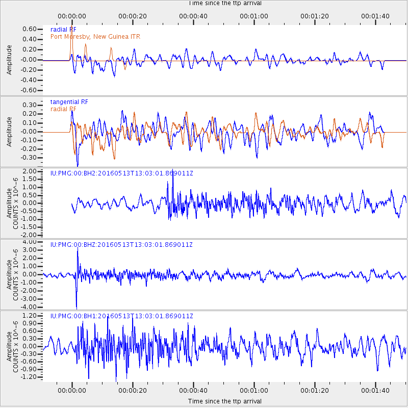
PMG Port Moresby, New Guinea - Earthquake Result Viewer
*The percent match for this event was below the threshold and hence no stack was calculated.
| Earthquake location: |
South Of Fiji Islands |
| Earthquake latitude/longitude: |
-25.5/179.3 |
| Earthquake time(UTC): |
2016/05/13 (134) 12:57:27 GMT |
| Earthquake Depth: |
506 km |
| Earthquake Magnitude: |
5.6 MWW |
| Earthquake Catalog/Contributor: |
NEIC PDE/NEIC COMCAT |
|
| Network: |
IU Global Seismograph Network (GSN - IRIS/USGS) |
| Station: |
PMG Port Moresby, New Guinea |
| Lat/Lon: |
9.40 S/147.16 E |
| Elevation: |
90 m |
|
| Distance: |
34.5 deg |
| Az: |
291.84 deg |
| Baz: |
121.762 deg |
| Ray Param: |
$rayparam |
*The percent match for this event was below the threshold and hence was not used in the summary stack. |
|
| Radial Match: |
55.993416 % |
| Radial Bump: |
400 |
| Transverse Match: |
53.46016 % |
| Transverse Bump: |
400 |
| SOD ConfigId: |
1609551 |
| Insert Time: |
2016-06-23 12:24:24.437 +0000 |
| GWidth: |
2.5 |
| Max Bumps: |
400 |
| Tol: |
0.001 |
|
Signal To Noise
| Channel | StoN | STA | LTA |
| IU:PMG:00:BHZ:20160513T13:03:01.869011Z | 7.5648727 | 1.0973288E-6 | 1.4505581E-7 |
| IU:PMG:00:BH1:20160513T13:03:01.869011Z | 1.9525855 | 3.723474E-7 | 1.9069454E-7 |
| IU:PMG:00:BH2:20160513T13:03:01.869011Z | 2.5988286 | 6.139047E-7 | 2.3622364E-7 |
| Arrivals |
| Ps | |
| PpPs | |
| PsPs/PpSs | |


