You are here: Home > Network List > TA - USArray Transportable Network (new EarthScope stations) Stations List
> Station M16K Timber Creek, AK, USA > Earthquake Result Viewer
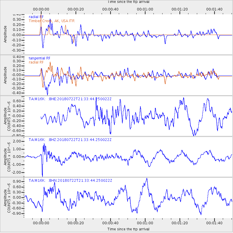
M16K Timber Creek, AK, USA - Earthquake Result Viewer
*The percent match for this event was below the threshold and hence no stack was calculated.
| Earthquake location: |
Vanuatu Islands |
| Earthquake latitude/longitude: |
-18.9/168.9 |
| Earthquake time(UTC): |
2018/07/22 (203) 21:21:57 GMT |
| Earthquake Depth: |
100 km |
| Earthquake Magnitude: |
5.5 Mww |
| Earthquake Catalog/Contributor: |
NEIC PDE/us |
|
| Network: |
TA USArray Transportable Network (new EarthScope stations) |
| Station: |
M16K Timber Creek, AK, USA |
| Lat/Lon: |
61.02 N/158.96 W |
| Elevation: |
394 m |
|
| Distance: |
83.8 deg |
| Az: |
15.1 deg |
| Baz: |
210.423 deg |
| Ray Param: |
$rayparam |
*The percent match for this event was below the threshold and hence was not used in the summary stack. |
|
| Radial Match: |
71.43121 % |
| Radial Bump: |
400 |
| Transverse Match: |
85.93214 % |
| Transverse Bump: |
400 |
| SOD ConfigId: |
13570011 |
| Insert Time: |
2019-04-30 15:41:16.256 +0000 |
| GWidth: |
2.5 |
| Max Bumps: |
400 |
| Tol: |
0.001 |
|
Signal To Noise
| Channel | StoN | STA | LTA |
| TA:M16K: :BHZ:20180722T21:33:44.250022Z | 4.2923822 | 9.4282336E-7 | 2.1965037E-7 |
| TA:M16K: :BHN:20180722T21:33:44.250022Z | 3.1683733 | 4.0343605E-7 | 1.2733223E-7 |
| TA:M16K: :BHE:20180722T21:33:44.250022Z | 1.1669924 | 2.6339248E-7 | 2.2570197E-7 |
| Arrivals |
| Ps | |
| PpPs | |
| PsPs/PpSs | |


