You are here: Home > Network List > TA - USArray Transportable Network (new EarthScope stations) Stations List
> Station 224A Corundas Mountain, Dell City, TX, USA > Earthquake Result Viewer
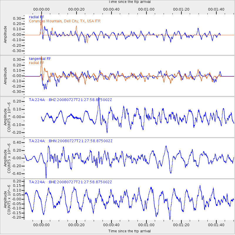
224A Corundas Mountain, Dell City, TX, USA - Earthquake Result Viewer
*The percent match for this event was below the threshold and hence no stack was calculated.
| Earthquake location: |
Central Mid-Atlantic Ridge |
| Earthquake latitude/longitude: |
-0.3/-18.3 |
| Earthquake time(UTC): |
2008/07/27 (209) 21:15:41 GMT |
| Earthquake Depth: |
10 km |
| Earthquake Magnitude: |
5.8 MB, 5.3 MS, 5.9 MW, 5.8 MW |
| Earthquake Catalog/Contributor: |
WHDF/NEIC |
|
| Network: |
TA USArray Transportable Network (new EarthScope stations) |
| Station: |
224A Corundas Mountain, Dell City, TX, USA |
| Lat/Lon: |
32.08 N/105.52 W |
| Elevation: |
1487 m |
|
| Distance: |
87.8 deg |
| Az: |
301.942 deg |
| Baz: |
91.684 deg |
| Ray Param: |
$rayparam |
*The percent match for this event was below the threshold and hence was not used in the summary stack. |
|
| Radial Match: |
52.217285 % |
| Radial Bump: |
379 |
| Transverse Match: |
66.93183 % |
| Transverse Bump: |
316 |
| SOD ConfigId: |
2504 |
| Insert Time: |
2010-03-06 13:06:39.982 +0000 |
| GWidth: |
2.5 |
| Max Bumps: |
400 |
| Tol: |
0.001 |
|
Signal To Noise
| Channel | StoN | STA | LTA |
| TA:224A: :BHN:20080727T21:27:58.875002Z | 3.2631402 | 1.9920886E-7 | 6.1048205E-8 |
| TA:224A: :BHE:20080727T21:27:58.875002Z | 1.6775464 | 8.982427E-8 | 5.3545026E-8 |
| TA:224A: :BHZ:20080727T21:27:58.875002Z | 2.6732478 | 9.832551E-8 | 3.678129E-8 |
| Arrivals |
| Ps | |
| PpPs | |
| PsPs/PpSs | |


