You are here: Home > Network List > AV - Alaska Volcano Observatory Stations List
> Station MAPS Pakushin Southeast, Makushin Volcano, Alaska > Earthquake Result Viewer
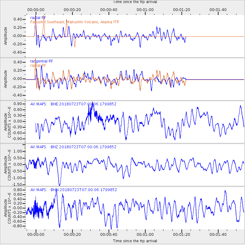
MAPS Pakushin Southeast, Makushin Volcano, Alaska - Earthquake Result Viewer
*The percent match for this event was below the threshold and hence no stack was calculated.
| Earthquake location: |
Hawaii |
| Earthquake latitude/longitude: |
19.4/-155.3 |
| Earthquake time(UTC): |
2018/07/23 (204) 06:53:38 GMT |
| Earthquake Depth: |
0.6 km |
| Earthquake Magnitude: |
5.5 Mwr |
| Earthquake Catalog/Contributor: |
NEIC PDE/hv |
|
| Network: |
AV Alaska Volcano Observatory |
| Station: |
MAPS Pakushin Southeast, Makushin Volcano, Alaska |
| Lat/Lon: |
53.81 N/166.94 W |
| Elevation: |
333 m |
|
| Distance: |
35.5 deg |
| Az: |
348.088 deg |
| Baz: |
160.823 deg |
| Ray Param: |
$rayparam |
*The percent match for this event was below the threshold and hence was not used in the summary stack. |
|
| Radial Match: |
58.937294 % |
| Radial Bump: |
352 |
| Transverse Match: |
65.059494 % |
| Transverse Bump: |
280 |
| SOD ConfigId: |
13570011 |
| Insert Time: |
2019-04-30 15:45:29.101 +0000 |
| GWidth: |
2.5 |
| Max Bumps: |
400 |
| Tol: |
0.001 |
|
Signal To Noise
| Channel | StoN | STA | LTA |
| AV:MAPS: :BHZ:20180723T07:00:06.179985Z | 1.0616403 | 2.3591126E-7 | 2.2221394E-7 |
| AV:MAPS: :BHN:20180723T07:00:06.179985Z | 1.0263364 | 2.1633574E-7 | 2.107844E-7 |
| AV:MAPS: :BHE:20180723T07:00:06.179985Z | 2.7694857 | 7.065215E-7 | 2.5510928E-7 |
| Arrivals |
| Ps | |
| PpPs | |
| PsPs/PpSs | |


