You are here: Home > Network List > TA - USArray Transportable Network (new EarthScope stations) Stations List
> Station F19A Roth Fram, Molt, MT, USA > Earthquake Result Viewer
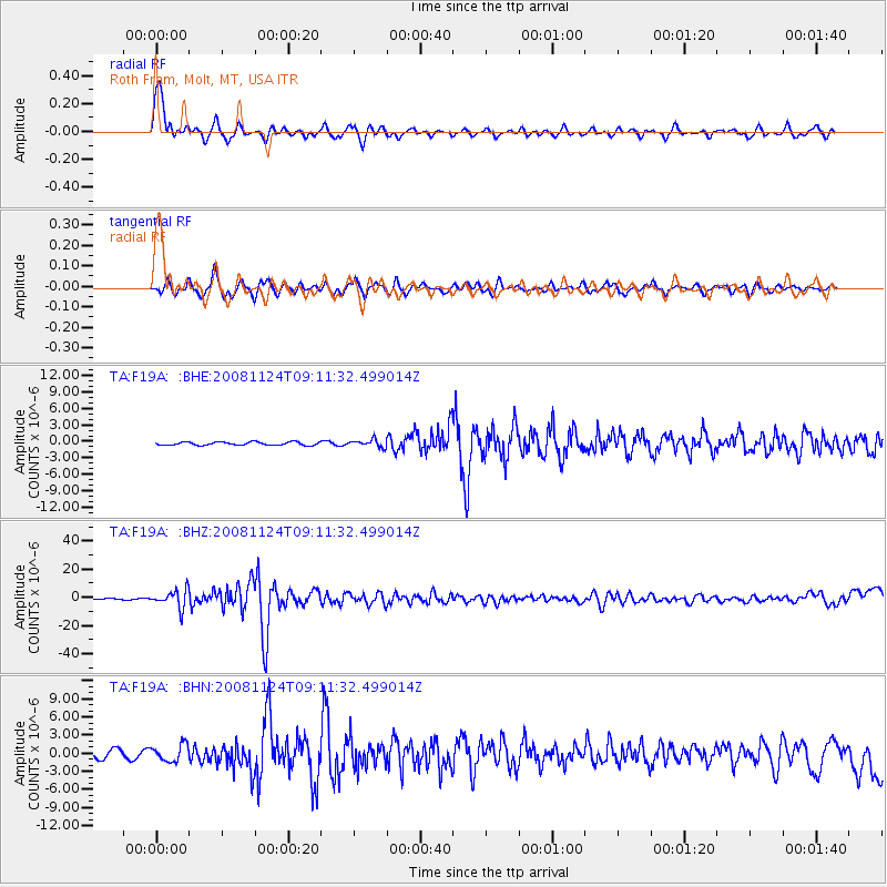
F19A Roth Fram, Molt, MT, USA - Earthquake Result Viewer

| Earthquake location: |
Sea Of Okhotsk |
| Earthquake latitude/longitude: |
54.2/154.3 |
| Earthquake time(UTC): |
2008/11/24 (329) 09:02:58 GMT |
| Earthquake Depth: |
492 km |
| Earthquake Magnitude: |
6.5 MB, 7.3 MW, 7.3 MW |
| Earthquake Catalog/Contributor: |
WHDF/NEIC |
|
| Network: |
TA USArray Transportable Network (new EarthScope stations) |
| Station: |
F19A Roth Fram, Molt, MT, USA |
| Lat/Lon: |
45.85 N/108.94 W |
| Elevation: |
1243 m |
|
| Distance: |
58.0 deg |
| Az: |
54.971 deg |
| Baz: |
316.501 deg |
| Ray Param: |
0.061226245 |
| Estimated Moho Depth: |
23.0 km |
| Estimated Crust Vp/Vs: |
1.60 |
| Assumed Crust Vp: |
6.242 km/s |
| Estimated Crust Vs: |
3.901 km/s |
| Estimated Crust Poisson's Ratio: |
0.18 |
|
| Radial Match: |
91.02023 % |
| Radial Bump: |
389 |
| Transverse Match: |
78.58092 % |
| Transverse Bump: |
373 |
| SOD ConfigId: |
2658 |
| Insert Time: |
2010-03-06 13:09:24.795 +0000 |
| GWidth: |
2.5 |
| Max Bumps: |
400 |
| Tol: |
0.001 |
|
Signal To Noise
| Channel | StoN | STA | LTA |
| TA:F19A: :BHZ:20081124T09:11:32.499014Z | 12.240584 | 6.2239324E-6 | 5.0846694E-7 |
| TA:F19A: :BHN:20081124T09:11:32.499014Z | 2.1898582 | 1.3931377E-6 | 6.3617716E-7 |
| TA:F19A: :BHE:20081124T09:11:32.499014Z | 2.252103 | 6.6621374E-7 | 2.958185E-7 |
| Arrivals |
| Ps | 2.3 SECOND |
| PpPs | 9.1 SECOND |
| PsPs/PpSs | 11 SECOND |


