You are here: Home > Network List > TA - USArray Transportable Network (new EarthScope stations) Stations List
> Station F19A Roth Fram, Molt, MT, USA > Earthquake Result Viewer
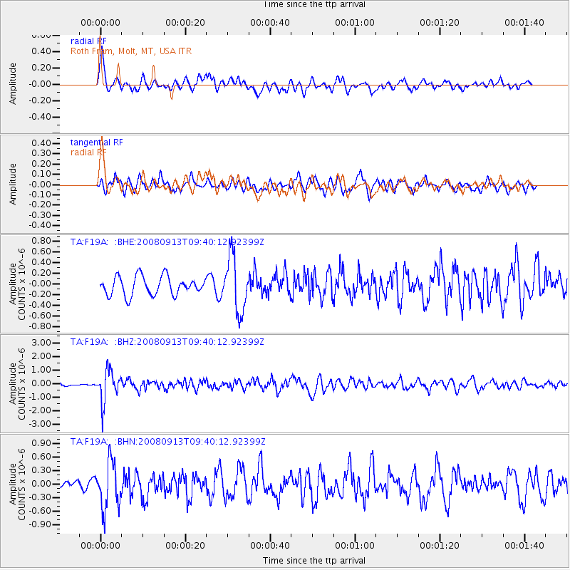
F19A Roth Fram, Molt, MT, USA - Earthquake Result Viewer
*The percent match for this event was below the threshold and hence no stack was calculated.
| Earthquake location: |
Colombia |
| Earthquake latitude/longitude: |
4.8/-75.5 |
| Earthquake time(UTC): |
2008/09/13 (257) 09:32:01 GMT |
| Earthquake Depth: |
133 km |
| Earthquake Magnitude: |
5.9 MB, 5.7 MW, 5.7 MW |
| Earthquake Catalog/Contributor: |
WHDF/NEIC |
|
| Network: |
TA USArray Transportable Network (new EarthScope stations) |
| Station: |
F19A Roth Fram, Molt, MT, USA |
| Lat/Lon: |
45.85 N/108.94 W |
| Elevation: |
1243 m |
|
| Distance: |
50.2 deg |
| Az: |
329.908 deg |
| Baz: |
134.362 deg |
| Ray Param: |
$rayparam |
*The percent match for this event was below the threshold and hence was not used in the summary stack. |
|
| Radial Match: |
58.87791 % |
| Radial Bump: |
400 |
| Transverse Match: |
55.686752 % |
| Transverse Bump: |
400 |
| SOD ConfigId: |
2560 |
| Insert Time: |
2010-03-06 13:10:10.429 +0000 |
| GWidth: |
2.5 |
| Max Bumps: |
400 |
| Tol: |
0.001 |
|
Signal To Noise
| Channel | StoN | STA | LTA |
| TA:F19A: :BHZ:20080913T09:40:12.92399Z | 10.242012 | 1.1723405E-6 | 1.1446388E-7 |
| TA:F19A: :BHN:20080913T09:40:12.92399Z | 4.994856 | 5.2691536E-7 | 1.0549161E-7 |
| TA:F19A: :BHE:20080913T09:40:12.92399Z | 3.0262742 | 5.2866284E-7 | 1.74691E-7 |
| Arrivals |
| Ps | |
| PpPs | |
| PsPs/PpSs | |


