You are here: Home > Network List > G - GEOSCOPE Stations List
> Station PPTF Pamatai - Papeete - Tahiti island - French Polynesia, France > Earthquake Result Viewer
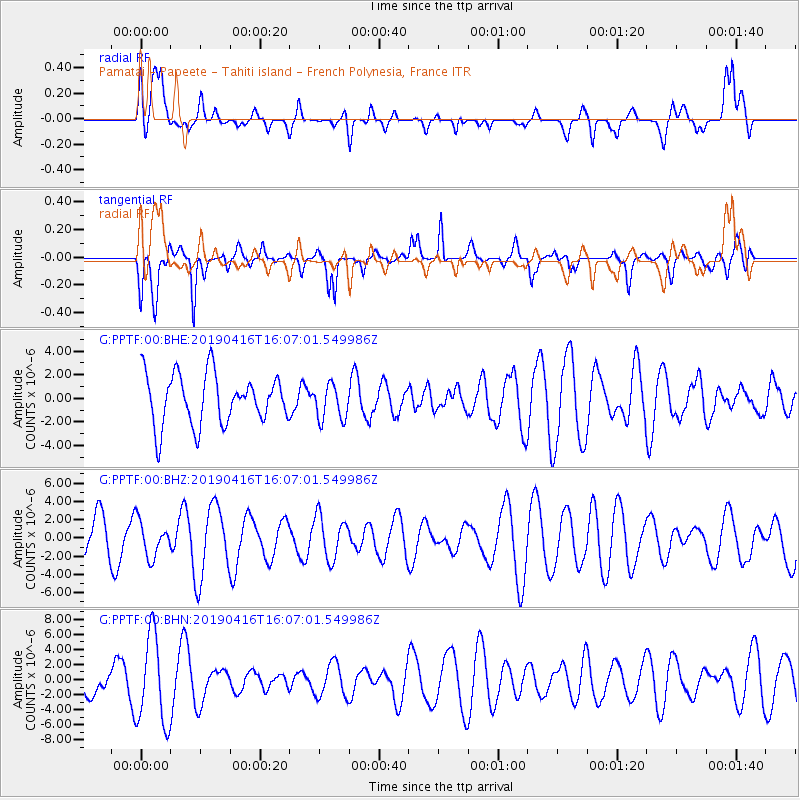
PPTF Pamatai - Papeete - Tahiti island - French Polynesia, France - Earthquake Result Viewer
*The percent match for this event was below the threshold and hence no stack was calculated.
| Earthquake location: |
South Of Kermadec Islands |
| Earthquake latitude/longitude: |
-32.4/-179.6 |
| Earthquake time(UTC): |
2019/04/16 (106) 16:01:16 GMT |
| Earthquake Depth: |
10 km |
| Earthquake Magnitude: |
5.5 Mww |
| Earthquake Catalog/Contributor: |
NEIC PDE/us |
|
| Network: |
G GEOSCOPE |
| Station: |
PPTF Pamatai - Papeete - Tahiti island - French Polynesia, France |
| Lat/Lon: |
17.59 S/149.57 W |
| Elevation: |
705 m |
|
| Distance: |
30.8 deg |
| Az: |
68.71 deg |
| Baz: |
235.756 deg |
| Ray Param: |
$rayparam |
*The percent match for this event was below the threshold and hence was not used in the summary stack. |
|
| Radial Match: |
34.950455 % |
| Radial Bump: |
400 |
| Transverse Match: |
69.11017 % |
| Transverse Bump: |
400 |
| SOD ConfigId: |
11735903 |
| Insert Time: |
2019-04-30 16:16:49.160 +0000 |
| GWidth: |
2.5 |
| Max Bumps: |
400 |
| Tol: |
0.001 |
|
Signal To Noise
| Channel | StoN | STA | LTA |
| G:PPTF:00:BHZ:20190416T16:07:01.549986Z | 0.7208226 | 1.9094289E-6 | 2.6489581E-6 |
| G:PPTF:00:BHN:20190416T16:07:01.549986Z | 2.8247156 | 5.908603E-6 | 2.0917514E-6 |
| G:PPTF:00:BHE:20190416T16:07:01.549986Z | 0.7065621 | 1.5025457E-6 | 2.1265587E-6 |
| Arrivals |
| Ps | |
| PpPs | |
| PsPs/PpSs | |


