You are here: Home > Network List > TA - USArray Transportable Network (new EarthScope stations) Stations List
> Station F19A Roth Fram, Molt, MT, USA > Earthquake Result Viewer
F19A Roth Fram, Molt, MT, USA - Earthquake Result Viewer
*The percent match for this event was below the threshold and hence no stack was calculated.
| Earthquake location: |
Hokkaido, Japan Region |
| Earthquake latitude/longitude: |
41.6/140.4 |
| Earthquake time(UTC): |
2008/09/22 (266) 07:31:59 GMT |
| Earthquake Depth: |
149 km |
| Earthquake Magnitude: |
5.7 MW, 5.3 MB, 5.6 MW |
| Earthquake Catalog/Contributor: |
WHDF/NEIC |
|
| Network: |
TA USArray Transportable Network (new EarthScope stations) |
| Station: |
F19A Roth Fram, Molt, MT, USA |
| Lat/Lon: |
45.85 N/108.94 W |
| Elevation: |
1243 m |
|
| Distance: |
73.2 deg |
| Az: |
43.094 deg |
| Baz: |
312.827 deg |
| Ray Param: |
$rayparam |
*The percent match for this event was below the threshold and hence was not used in the summary stack. |
|
| Radial Match: |
53.410336 % |
| Radial Bump: |
375 |
| Transverse Match: |
46.44828 % |
| Transverse Bump: |
373 |
| SOD ConfigId: |
2560 |
| Insert Time: |
2010-03-06 13:10:13.292 +0000 |
| GWidth: |
2.5 |
| Max Bumps: |
400 |
| Tol: |
0.001 |
|
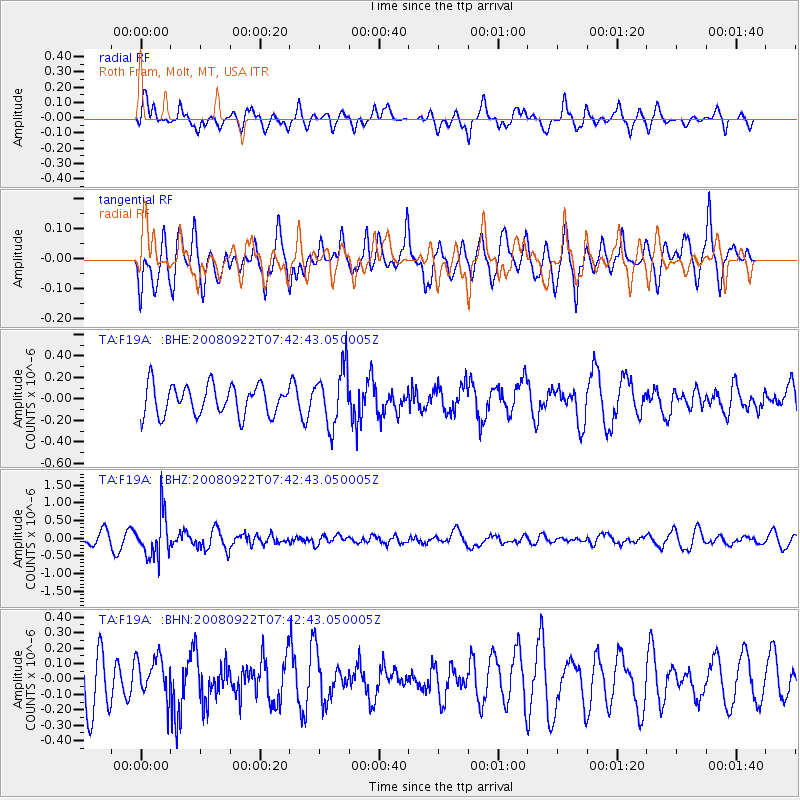
Signal To Noise
| Channel | StoN | STA | LTA |
| TA:F19A: :BHZ:20080922T07:42:43.050005Z | 4.718577 | 6.075206E-7 | 1.2875081E-7 |
| TA:F19A: :BHN:20080922T07:42:43.050005Z | 0.77780914 | 1.3154735E-7 | 1.6912549E-7 |
| TA:F19A: :BHE:20080922T07:42:43.050005Z | 1.8810525 | 2.6141166E-7 | 1.3897096E-7 |
| Arrivals |
| Ps | |
| PpPs | |
| PsPs/PpSs | |


