You are here: Home > Network List > TA - USArray Transportable Network (new EarthScope stations) Stations List
> Station F19A Roth Fram, Molt, MT, USA > Earthquake Result Viewer
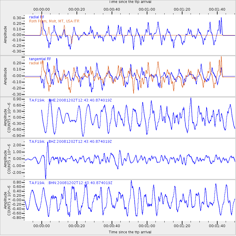
F19A Roth Fram, Molt, MT, USA - Earthquake Result Viewer
*The percent match for this event was below the threshold and hence no stack was calculated.
| Earthquake location: |
Mariana Islands |
| Earthquake latitude/longitude: |
19.1/145.8 |
| Earthquake time(UTC): |
2008/12/02 (337) 12:31:43 GMT |
| Earthquake Depth: |
137 km |
| Earthquake Magnitude: |
5.9 MB, 5.9 MW, 5.9 MW |
| Earthquake Catalog/Contributor: |
WHDF/NEIC |
|
| Network: |
TA USArray Transportable Network (new EarthScope stations) |
| Station: |
F19A Roth Fram, Molt, MT, USA |
| Lat/Lon: |
45.85 N/108.94 W |
| Elevation: |
1243 m |
|
| Distance: |
86.7 deg |
| Az: |
42.474 deg |
| Baz: |
293.994 deg |
| Ray Param: |
$rayparam |
*The percent match for this event was below the threshold and hence was not used in the summary stack. |
|
| Radial Match: |
61.67119 % |
| Radial Bump: |
361 |
| Transverse Match: |
64.61347 % |
| Transverse Bump: |
341 |
| SOD ConfigId: |
2658 |
| Insert Time: |
2010-03-06 13:11:05.041 +0000 |
| GWidth: |
2.5 |
| Max Bumps: |
400 |
| Tol: |
0.001 |
|
Signal To Noise
| Channel | StoN | STA | LTA |
| TA:F19A: :BHZ:20081202T12:43:40.874019Z | 5.879782 | 1.2197152E-6 | 2.0744224E-7 |
| TA:F19A: :BHN:20081202T12:43:40.874019Z | 1.3538642 | 4.0946912E-7 | 3.0244476E-7 |
| TA:F19A: :BHE:20081202T12:43:40.874019Z | 0.66799086 | 2.8991923E-7 | 4.3401675E-7 |
| Arrivals |
| Ps | |
| PpPs | |
| PsPs/PpSs | |


