You are here: Home > Network List > TA - USArray Transportable Network (new EarthScope stations) Stations List
> Station O18K Koktuh Hills, AK, USA > Earthquake Result Viewer
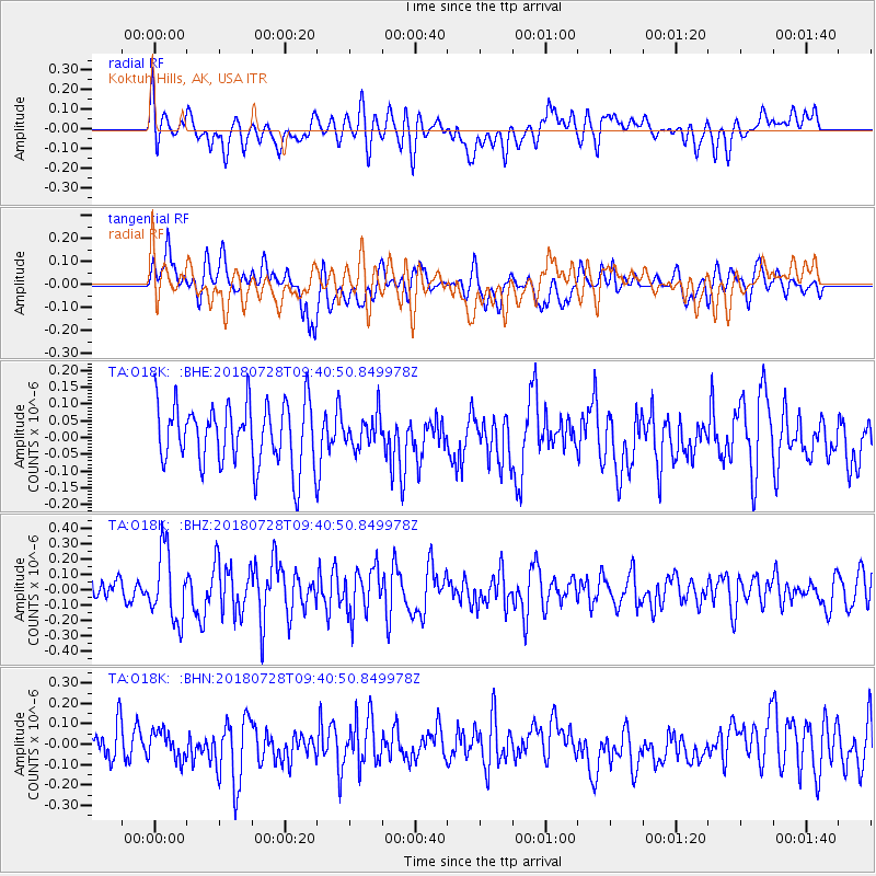
O18K Koktuh Hills, AK, USA - Earthquake Result Viewer
*The percent match for this event was below the threshold and hence no stack was calculated.
| Earthquake location: |
Kermadec Islands, New Zealand |
| Earthquake latitude/longitude: |
-30.0/-177.4 |
| Earthquake time(UTC): |
2018/07/28 (209) 09:28:20 GMT |
| Earthquake Depth: |
35 km |
| Earthquake Magnitude: |
5.6 Mww |
| Earthquake Catalog/Contributor: |
NEIC PDE/us |
|
| Network: |
TA USArray Transportable Network (new EarthScope stations) |
| Station: |
O18K Koktuh Hills, AK, USA |
| Lat/Lon: |
59.85 N/155.21 W |
| Elevation: |
544 m |
|
| Distance: |
91.4 deg |
| Az: |
11.011 deg |
| Baz: |
199.168 deg |
| Ray Param: |
$rayparam |
*The percent match for this event was below the threshold and hence was not used in the summary stack. |
|
| Radial Match: |
54.76634 % |
| Radial Bump: |
400 |
| Transverse Match: |
53.86999 % |
| Transverse Bump: |
400 |
| SOD ConfigId: |
13570011 |
| Insert Time: |
2019-04-30 16:28:05.192 +0000 |
| GWidth: |
2.5 |
| Max Bumps: |
400 |
| Tol: |
0.001 |
|
Signal To Noise
| Channel | StoN | STA | LTA |
| TA:O18K: :BHZ:20180728T09:40:50.849978Z | 3.5603666 | 2.2598323E-7 | 6.3471894E-8 |
| TA:O18K: :BHN:20180728T09:40:50.849978Z | 0.9548 | 6.817951E-8 | 7.140711E-8 |
| TA:O18K: :BHE:20180728T09:40:50.849978Z | 0.5110185 | 4.7963464E-8 | 9.385856E-8 |
| Arrivals |
| Ps | |
| PpPs | |
| PsPs/PpSs | |


