You are here: Home > Network List > TA - USArray Transportable Network (new EarthScope stations) Stations List
> Station F19A Roth Fram, Molt, MT, USA > Earthquake Result Viewer
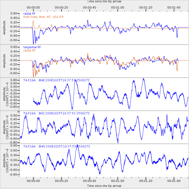
F19A Roth Fram, Molt, MT, USA - Earthquake Result Viewer
*The percent match for this event was below the threshold and hence no stack was calculated.
| Earthquake location: |
Vanuatu Islands |
| Earthquake latitude/longitude: |
-17.2/167.3 |
| Earthquake time(UTC): |
2008/10/25 (299) 19:24:50 GMT |
| Earthquake Depth: |
23 km |
| Earthquake Magnitude: |
5.7 MB, 5.3 MS, 5.7 MW, 5.7 MW |
| Earthquake Catalog/Contributor: |
WHDF/NEIC |
|
| Network: |
TA USArray Transportable Network (new EarthScope stations) |
| Station: |
F19A Roth Fram, Molt, MT, USA |
| Lat/Lon: |
45.85 N/108.94 W |
| Elevation: |
1243 m |
|
| Distance: |
98.0 deg |
| Az: |
44.552 deg |
| Baz: |
253.606 deg |
| Ray Param: |
$rayparam |
*The percent match for this event was below the threshold and hence was not used in the summary stack. |
|
| Radial Match: |
53.52433 % |
| Radial Bump: |
400 |
| Transverse Match: |
40.98011 % |
| Transverse Bump: |
400 |
| SOD ConfigId: |
2560 |
| Insert Time: |
2010-03-06 13:12:08.399 +0000 |
| GWidth: |
2.5 |
| Max Bumps: |
400 |
| Tol: |
0.001 |
|
Signal To Noise
| Channel | StoN | STA | LTA |
| TA:F19A: :BHZ:20081025T19:37:53.250027Z | 1.007376 | 3.068024E-7 | 3.0455604E-7 |
| TA:F19A: :BHN:20081025T19:37:53.250027Z | 0.7128839 | 2.31584E-7 | 3.2485516E-7 |
| TA:F19A: :BHE:20081025T19:37:53.250027Z | 1.5234513 | 5.124402E-7 | 3.3636795E-7 |
| Arrivals |
| Ps | |
| PpPs | |
| PsPs/PpSs | |


