You are here: Home > Network List > AV - Alaska Volcano Observatory Stations List
> Station AMKA Regional Station, Amchitka Island, Alaska > Earthquake Result Viewer
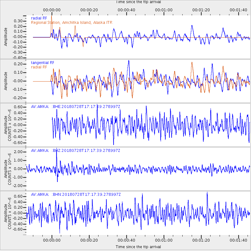
AMKA Regional Station, Amchitka Island, Alaska - Earthquake Result Viewer
*The percent match for this event was below the threshold and hence no stack was calculated.
| Earthquake location: |
Flores Sea |
| Earthquake latitude/longitude: |
-7.1/122.7 |
| Earthquake time(UTC): |
2018/07/28 (209) 17:07:23 GMT |
| Earthquake Depth: |
577 km |
| Earthquake Magnitude: |
6.0 Mww |
| Earthquake Catalog/Contributor: |
NEIC PDE/us |
|
| Network: |
AV Alaska Volcano Observatory |
| Station: |
AMKA Regional Station, Amchitka Island, Alaska |
| Lat/Lon: |
51.38 N/179.30 E |
| Elevation: |
116 m |
|
| Distance: |
75.7 deg |
| Az: |
32.66 deg |
| Baz: |
238.704 deg |
| Ray Param: |
$rayparam |
*The percent match for this event was below the threshold and hence was not used in the summary stack. |
|
| Radial Match: |
58.159725 % |
| Radial Bump: |
400 |
| Transverse Match: |
50.73978 % |
| Transverse Bump: |
400 |
| SOD ConfigId: |
13570011 |
| Insert Time: |
2019-04-30 16:30:57.847 +0000 |
| GWidth: |
2.5 |
| Max Bumps: |
400 |
| Tol: |
0.001 |
|
Signal To Noise
| Channel | StoN | STA | LTA |
| AV:AMKA: :BHZ:20180728T17:17:39.278997Z | 2.1292539 | 6.501882E-7 | 3.0535966E-7 |
| AV:AMKA: :BHN:20180728T17:17:39.278997Z | 1.1948414 | 2.4999986E-7 | 2.0923267E-7 |
| AV:AMKA: :BHE:20180728T17:17:39.278997Z | 1.0093783 | 2.1356327E-7 | 2.1157902E-7 |
| Arrivals |
| Ps | |
| PpPs | |
| PsPs/PpSs | |


