You are here: Home > Network List > TA - USArray Transportable Network (new EarthScope stations) Stations List
> Station F20K Avaraart Lake, AK, USA > Earthquake Result Viewer
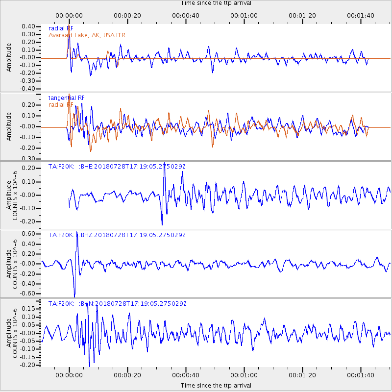
F20K Avaraart Lake, AK, USA - Earthquake Result Viewer
*The percent match for this event was below the threshold and hence no stack was calculated.
| Earthquake location: |
Flores Sea |
| Earthquake latitude/longitude: |
-7.1/122.7 |
| Earthquake time(UTC): |
2018/07/28 (209) 17:07:23 GMT |
| Earthquake Depth: |
577 km |
| Earthquake Magnitude: |
6.0 Mww |
| Earthquake Catalog/Contributor: |
NEIC PDE/us |
|
| Network: |
TA USArray Transportable Network (new EarthScope stations) |
| Station: |
F20K Avaraart Lake, AK, USA |
| Lat/Lon: |
67.05 N/155.73 W |
| Elevation: |
136 m |
|
| Distance: |
93.2 deg |
| Az: |
22.861 deg |
| Baz: |
259.45 deg |
| Ray Param: |
$rayparam |
*The percent match for this event was below the threshold and hence was not used in the summary stack. |
|
| Radial Match: |
69.88697 % |
| Radial Bump: |
400 |
| Transverse Match: |
60.575245 % |
| Transverse Bump: |
400 |
| SOD ConfigId: |
13570011 |
| Insert Time: |
2019-04-30 16:33:01.330 +0000 |
| GWidth: |
2.5 |
| Max Bumps: |
400 |
| Tol: |
0.001 |
|
Signal To Noise
| Channel | StoN | STA | LTA |
| TA:F20K: :BHZ:20180728T17:19:05.275029Z | 7.928963 | 2.7340135E-7 | 3.448135E-8 |
| TA:F20K: :BHN:20180728T17:19:05.275029Z | 1.5803336 | 5.2717006E-8 | 3.3358152E-8 |
| TA:F20K: :BHE:20180728T17:19:05.275029Z | 3.2387505 | 9.750249E-8 | 3.010497E-8 |
| Arrivals |
| Ps | |
| PpPs | |
| PsPs/PpSs | |


