You are here: Home > Network List > TA - USArray Transportable Network (new EarthScope stations) Stations List
> Station G16K Koyuk River, AK, USA > Earthquake Result Viewer
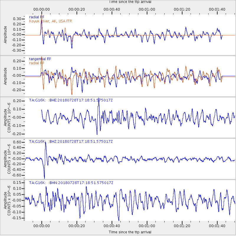
G16K Koyuk River, AK, USA - Earthquake Result Viewer
*The percent match for this event was below the threshold and hence no stack was calculated.
| Earthquake location: |
Flores Sea |
| Earthquake latitude/longitude: |
-7.1/122.7 |
| Earthquake time(UTC): |
2018/07/28 (209) 17:07:23 GMT |
| Earthquake Depth: |
577 km |
| Earthquake Magnitude: |
6.0 Mww |
| Earthquake Catalog/Contributor: |
NEIC PDE/us |
|
| Network: |
TA USArray Transportable Network (new EarthScope stations) |
| Station: |
G16K Koyuk River, AK, USA |
| Lat/Lon: |
65.39 N/162.35 W |
| Elevation: |
169 m |
|
| Distance: |
90.2 deg |
| Az: |
23.844 deg |
| Baz: |
253.359 deg |
| Ray Param: |
$rayparam |
*The percent match for this event was below the threshold and hence was not used in the summary stack. |
|
| Radial Match: |
60.08447 % |
| Radial Bump: |
400 |
| Transverse Match: |
69.631645 % |
| Transverse Bump: |
400 |
| SOD ConfigId: |
13570011 |
| Insert Time: |
2019-04-30 16:33:04.662 +0000 |
| GWidth: |
2.5 |
| Max Bumps: |
400 |
| Tol: |
0.001 |
|
Signal To Noise
| Channel | StoN | STA | LTA |
| TA:G16K: :BHZ:20180728T17:18:51.575017Z | 5.2046957 | 2.8257296E-7 | 5.4291924E-8 |
| TA:G16K: :BHN:20180728T17:18:51.575017Z | 1.6970766 | 5.4338436E-8 | 3.201885E-8 |
| TA:G16K: :BHE:20180728T17:18:51.575017Z | 2.1499286 | 9.941268E-8 | 4.6239993E-8 |
| Arrivals |
| Ps | |
| PpPs | |
| PsPs/PpSs | |


