You are here: Home > Network List > TA - USArray Transportable Network (new EarthScope stations) Stations List
> Station W24A Lazy 6 Ranch, Villanueva, NM, USA > Earthquake Result Viewer
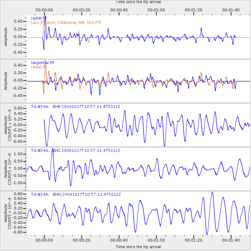
W24A Lazy 6 Ranch, Villanueva, NM, USA - Earthquake Result Viewer
*The percent match for this event was below the threshold and hence no stack was calculated.
| Earthquake location: |
Samoa Islands Region |
| Earthquake latitude/longitude: |
-16.4/-172.0 |
| Earthquake time(UTC): |
2009/10/17 (290) 10:45:26 GMT |
| Earthquake Depth: |
10 km |
| Earthquake Magnitude: |
5.7 MB, 5.3 MS, 5.7 MW, 5.7 MW |
| Earthquake Catalog/Contributor: |
WHDF/NEIC |
|
| Network: |
TA USArray Transportable Network (new EarthScope stations) |
| Station: |
W24A Lazy 6 Ranch, Villanueva, NM, USA |
| Lat/Lon: |
35.21 N/105.41 W |
| Elevation: |
1902 m |
|
| Distance: |
81.3 deg |
| Az: |
49.481 deg |
| Baz: |
243.027 deg |
| Ray Param: |
$rayparam |
*The percent match for this event was below the threshold and hence was not used in the summary stack. |
|
| Radial Match: |
61.768295 % |
| Radial Bump: |
400 |
| Transverse Match: |
45.68275 % |
| Transverse Bump: |
334 |
| SOD ConfigId: |
2622 |
| Insert Time: |
2010-03-06 13:15:38.130 +0000 |
| GWidth: |
2.5 |
| Max Bumps: |
400 |
| Tol: |
0.001 |
|
Signal To Noise
| Channel | StoN | STA | LTA |
| TA:W24A: :BHZ:20091017T10:57:11.475012Z | 5.5102687 | 6.1237284E-7 | 1.11133026E-7 |
| TA:W24A: :BHN:20091017T10:57:11.475012Z | 0.9875812 | 1.793328E-7 | 1.8158791E-7 |
| TA:W24A: :BHE:20091017T10:57:11.475012Z | 0.54880476 | 1.455405E-7 | 2.651954E-7 |
| Arrivals |
| Ps | |
| PpPs | |
| PsPs/PpSs | |


