You are here: Home > Network List > TA - USArray Transportable Network (new EarthScope stations) Stations List
> Station M31M Drury Creek, Yukon, CA > Earthquake Result Viewer
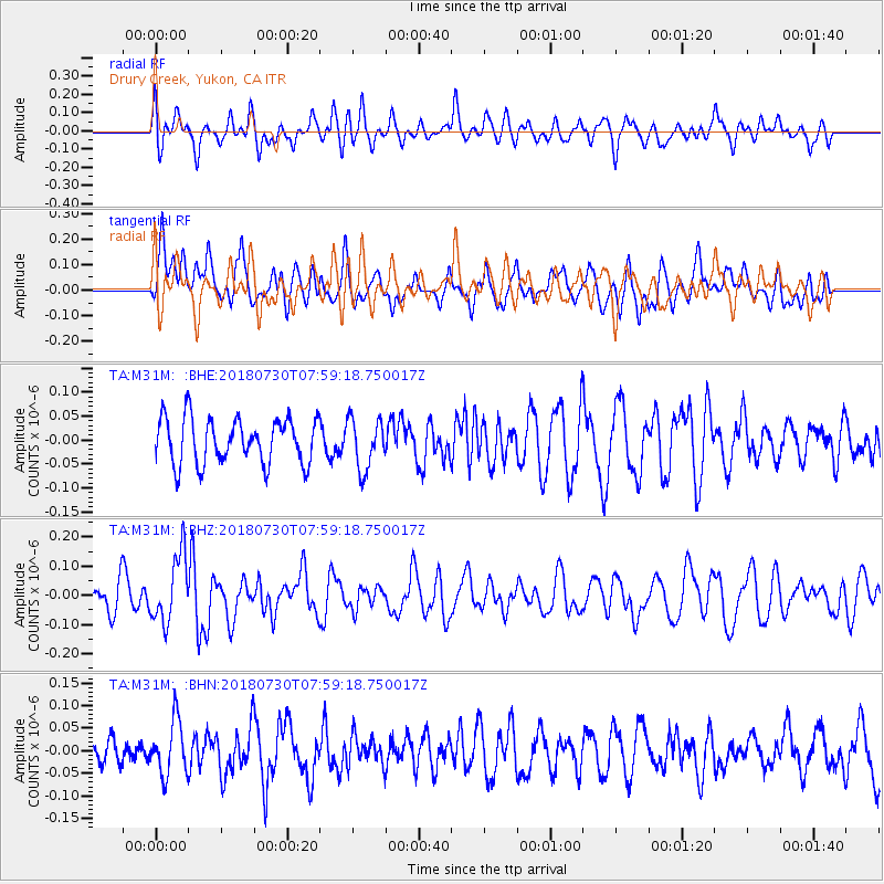
M31M Drury Creek, Yukon, CA - Earthquake Result Viewer
*The percent match for this event was below the threshold and hence no stack was calculated.
| Earthquake location: |
Eastern New Guinea Reg., P.N.G. |
| Earthquake latitude/longitude: |
-9.8/150.8 |
| Earthquake time(UTC): |
2018/07/30 (211) 07:46:43 GMT |
| Earthquake Depth: |
10 km |
| Earthquake Magnitude: |
5.4 Mww |
| Earthquake Catalog/Contributor: |
NEIC PDE/us |
|
| Network: |
TA USArray Transportable Network (new EarthScope stations) |
| Station: |
M31M Drury Creek, Yukon, CA |
| Lat/Lon: |
62.20 N/134.39 W |
| Elevation: |
639 m |
|
| Distance: |
91.6 deg |
| Az: |
26.907 deg |
| Baz: |
252.083 deg |
| Ray Param: |
$rayparam |
*The percent match for this event was below the threshold and hence was not used in the summary stack. |
|
| Radial Match: |
57.090633 % |
| Radial Bump: |
400 |
| Transverse Match: |
53.52786 % |
| Transverse Bump: |
400 |
| SOD ConfigId: |
13570011 |
| Insert Time: |
2019-04-30 16:47:25.373 +0000 |
| GWidth: |
2.5 |
| Max Bumps: |
400 |
| Tol: |
0.001 |
|
Signal To Noise
| Channel | StoN | STA | LTA |
| TA:M31M: :BHZ:20180730T07:59:18.750017Z | 2.9360318 | 1.1511418E-7 | 3.9207404E-8 |
| TA:M31M: :BHN:20180730T07:59:18.750017Z | 1.3717531 | 5.9246346E-8 | 4.3190237E-8 |
| TA:M31M: :BHE:20180730T07:59:18.750017Z | 1.117169 | 5.2596583E-8 | 4.7080235E-8 |
| Arrivals |
| Ps | |
| PpPs | |
| PsPs/PpSs | |


