You are here: Home > Network List > CN - Canadian National Seismograph Network Stations List
> Station INK INUVIK, NT > Earthquake Result Viewer
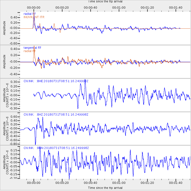
INK INUVIK, NT - Earthquake Result Viewer
*The percent match for this event was below the threshold and hence no stack was calculated.
| Earthquake location: |
Near East Coast Of Honshu, Japan |
| Earthquake latitude/longitude: |
37.2/141.2 |
| Earthquake time(UTC): |
2018/07/31 (212) 08:42:20 GMT |
| Earthquake Depth: |
10 km |
| Earthquake Magnitude: |
5.4 Mww |
| Earthquake Catalog/Contributor: |
NEIC PDE/us |
|
| Network: |
CN Canadian National Seismograph Network |
| Station: |
INK INUVIK, NT |
| Lat/Lon: |
68.31 N/133.53 W |
| Elevation: |
44 m |
|
| Distance: |
54.3 deg |
| Az: |
27.129 deg |
| Baz: |
281.576 deg |
| Ray Param: |
$rayparam |
*The percent match for this event was below the threshold and hence was not used in the summary stack. |
|
| Radial Match: |
76.13319 % |
| Radial Bump: |
400 |
| Transverse Match: |
73.957565 % |
| Transverse Bump: |
400 |
| SOD ConfigId: |
13570011 |
| Insert Time: |
2019-04-30 16:52:58.702 +0000 |
| GWidth: |
2.5 |
| Max Bumps: |
400 |
| Tol: |
0.001 |
|
Signal To Noise
| Channel | StoN | STA | LTA |
| CN:INK: :BHZ:20180731T08:51:16.249998Z | 8.154574 | 3.34193E-7 | 4.0982272E-8 |
| CN:INK: :BHN:20180731T08:51:16.249998Z | 2.8925664 | 8.264003E-8 | 2.8569795E-8 |
| CN:INK: :BHE:20180731T08:51:16.249998Z | 3.9123178 | 1.3820902E-7 | 3.5326636E-8 |
| Arrivals |
| Ps | |
| PpPs | |
| PsPs/PpSs | |


