E18A Harlowton, MT, USA - Earthquake Result Viewer
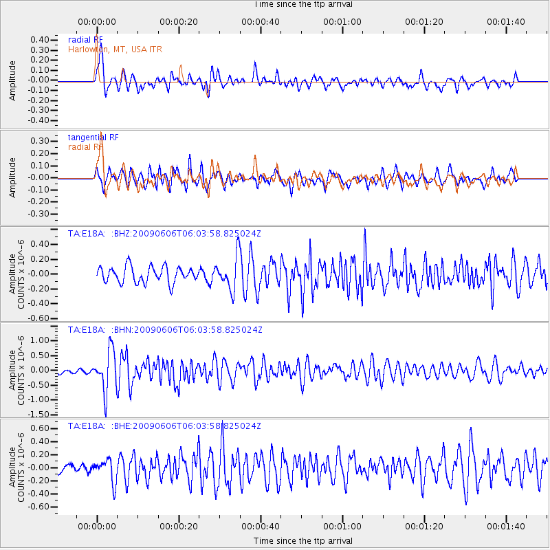
Earthquake location: Near East Coast Of Honshu, Japan
Earthquake latitude/longitude: 35.5/140.9
Earthquake time(UTC): 2009/06/06 (157) 05:52:43 GMT
Earthquake Depth: 34 km
Earthquake Magnitude: 5.8 MB, 5.4 MS, 5.8 MW, 5.7 MW
Earthquake Catalog/Contributor: WHDF/NEIC
Network: TA USArray Transportable Network (new EarthScope stations)
Station: E18A Harlowton, MT, USA
Lat/Lon: 46.57 N/109.91 W
Elevation: 1459 m
Distance: 76.5 deg
Az: 42.081 deg
Baz: 307.557 deg
Ray Param: 0.050901324
Estimated Moho Depth: 11.0 km
Estimated Crust Vp/Vs: 1.66
Assumed Crust Vp: 6.518 km/s
Estimated Crust Vs: 3.921 km/s
Estimated Crust Poisson's Ratio: 0.22
Radial Match: 84.23205 %
Radial Bump: 400
Transverse Match: 81.68631 %
Transverse Bump: 400
SOD ConfigId: 2648
Insert Time: 2010-03-06 13:18:11.221 +0000
GWidth: 2.5
Max Bumps: 400
Tol: 0.001

Signal To Noise

ChannelStoNSTALTA
TA:E18A: :BHN:20090606T06:03:58.825024Z9.790347.070602E-77.222019E-8
TA:E18A: :BHE:20090606T06:03:58.825024Z2.26034951.8044628E-77.983114E-8
TA:E18A: :BHZ:20090606T06:03:58.825024Z2.18923282.3185693E-71.0590785E-7
Arrivals
Ps1.2 SECOND
PpPs4.3 SECOND
PsPs/PpSs5.5 SECOND