KMBO Kilima Mbogo, Kenya - Earthquake Result Viewer
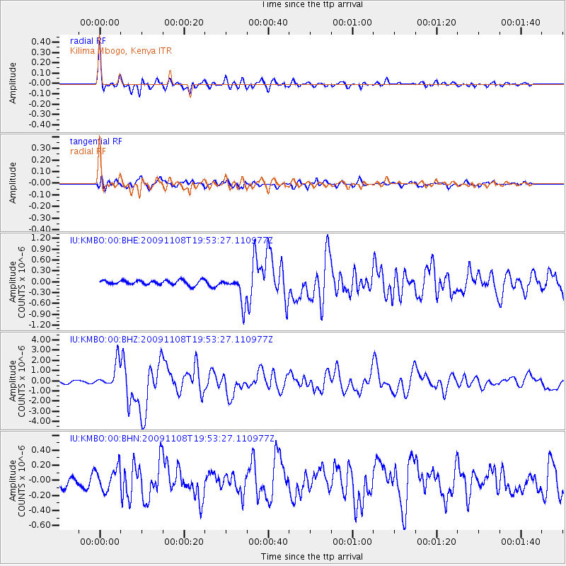
Earthquake location: Sumbawa Region, Indonesia
Earthquake latitude/longitude: -8.2/118.6
Earthquake time(UTC): 2009/11/08 (312) 19:41:43 GMT
Earthquake Depth: 18 km
Earthquake Magnitude: 6.3 MB, 6.5 MS, 6.6 MW, 6.5 MW
Earthquake Catalog/Contributor: WHDF/NEIC
Network: IU Global Seismograph Network (GSN - IRIS/USGS)
Station: KMBO Kilima Mbogo, Kenya
Lat/Lon: 1.13 S/37.25 E
Elevation: 1950 m
Distance: 81.3 deg
Az: 270.111 deg
Baz: 98.077 deg
Ray Param: 0.047663823
Estimated Moho Depth: 41.25 km
Estimated Crust Vp/Vs: 1.75
Assumed Crust Vp: 6.601 km/s
Estimated Crust Vs: 3.783 km/s
Estimated Crust Poisson's Ratio: 0.26
Radial Match: 93.91005 %
Radial Bump: 400
Transverse Match: 84.157555 %
Transverse Bump: 400
SOD ConfigId: 1
Insert Time: 2010-02-19 01:07:32.598 +0000
GWidth: 2.5
Max Bumps: 400
Tol: 0.001

Signal To Noise

ChannelStoNSTALTA
IU:KMBO:00:BHZ:20091108T19:53:27.110977Z12.002591.2761716E-61.06324684E-7
IU:KMBO:00:BHN:20091108T19:53:27.110977Z2.29124551.5066063E-76.5754904E-8
IU:KMBO:00:BHE:20091108T19:53:27.110977Z6.2886123.9192102E-76.232234E-8
Arrivals
Ps4.8 SECOND
PpPs17 SECOND
PsPs/PpSs21 SECOND