You are here: Home > Network List > TA - USArray Transportable Network (new EarthScope stations) Stations List
> Station E18A Harlowton, MT, USA > Earthquake Result Viewer
E18A Harlowton, MT, USA - Earthquake Result Viewer

| Earthquake location: |
Southern Peru |
| Earthquake latitude/longitude: |
-15.0/-70.4 |
| Earthquake time(UTC): |
2009/07/12 (193) 06:12:47 GMT |
| Earthquake Depth: |
199 km |
| Earthquake Magnitude: |
5.7 MB, 6.1 MW, 6.1 MW |
| Earthquake Catalog/Contributor: |
WHDF/NEIC |
|
| Network: |
TA USArray Transportable Network (new EarthScope stations) |
| Station: |
E18A Harlowton, MT, USA |
| Lat/Lon: |
46.57 N/109.91 W |
| Elevation: |
1459 m |
|
| Distance: |
70.9 deg |
| Az: |
332.339 deg |
| Baz: |
139.451 deg |
| Ray Param: |
0.0541608 |
| Estimated Moho Depth: |
44.0 km |
| Estimated Crust Vp/Vs: |
1.83 |
| Assumed Crust Vp: |
6.518 km/s |
| Estimated Crust Vs: |
3.562 km/s |
| Estimated Crust Poisson's Ratio: |
0.29 |
|
| Radial Match: |
87.759476 % |
| Radial Bump: |
400 |
| Transverse Match: |
81.63634 % |
| Transverse Bump: |
400 |
| SOD ConfigId: |
2648 |
| Insert Time: |
2010-03-06 13:18:23.137 +0000 |
| GWidth: |
2.5 |
| Max Bumps: |
400 |
| Tol: |
0.001 |
|
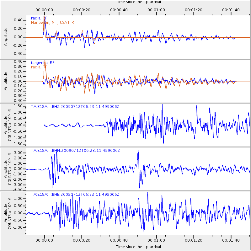
Signal To Noise
| Channel | StoN | STA | LTA |
| TA:E18A: :BHN:20090712T06:23:11.499006Z | 23.516735 | 1.2312603E-6 | 5.235677E-8 |
| TA:E18A: :BHE:20090712T06:23:11.499006Z | 2.2258534 | 2.0464554E-7 | 9.1940265E-8 |
| TA:E18A: :BHZ:20090712T06:23:11.499006Z | 2.3154058 | 1.688448E-7 | 7.292233E-8 |
| Arrivals |
| Ps | 5.8 SECOND |
| PpPs | 18 SECOND |
| PsPs/PpSs | 24 SECOND |


