E18A Harlowton, MT, USA - Earthquake Result Viewer
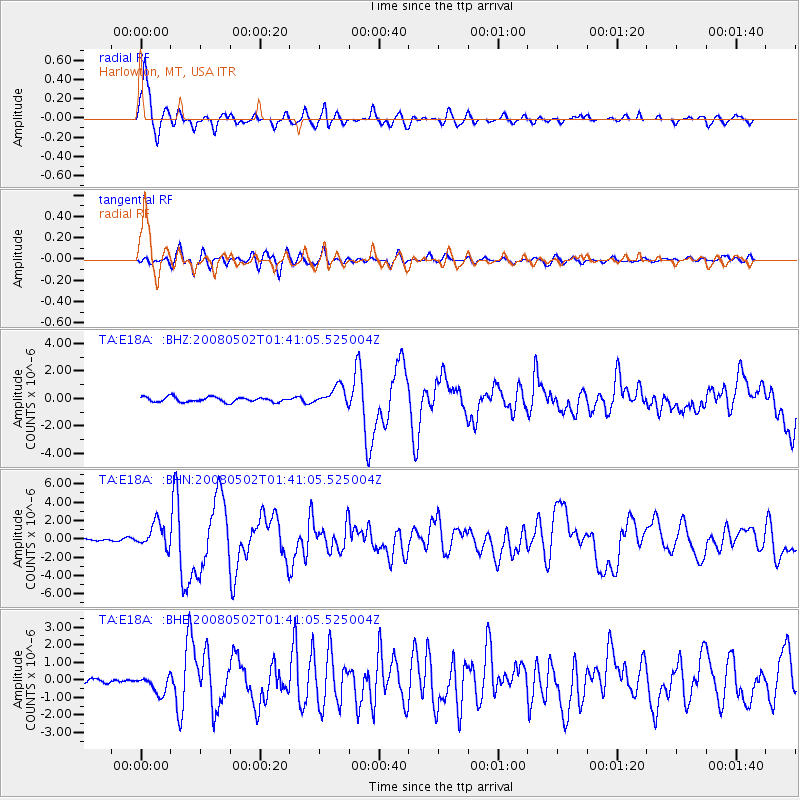
Earthquake location: Andreanof Islands, Aleutian Is.
Earthquake latitude/longitude: 51.9/-177.5
Earthquake time(UTC): 2008/05/02 (123) 01:33:37 GMT
Earthquake Depth: 14 km
Earthquake Magnitude: 6.3 MB, 6.8 MS, 6.6 MW, 6.6 MW
Earthquake Catalog/Contributor: WHDF/NEIC
Network: TA USArray Transportable Network (new EarthScope stations)
Station: E18A Harlowton, MT, USA
Lat/Lon: 46.57 N/109.91 W
Elevation: 1459 m
Distance: 43.0 deg
Az: 69.17 deg
Baz: 302.858 deg
Ray Param: 0.07279401
Estimated Moho Depth: 12.25 km
Estimated Crust Vp/Vs: 1.61
Assumed Crust Vp: 6.518 km/s
Estimated Crust Vs: 4.049 km/s
Estimated Crust Poisson's Ratio: 0.19
Radial Match: 94.17541 %
Radial Bump: 343
Transverse Match: 83.994835 %
Transverse Bump: 400
SOD ConfigId: 2504
Insert Time: 2010-03-06 13:19:05.783 +0000
GWidth: 2.5
Max Bumps: 400
Tol: 0.001

Signal To Noise

ChannelStoNSTALTA
TA:E18A: :BHN:20080502T01:41:05.525004Z13.4051531.3275373E-69.903187E-8
TA:E18A: :BHE:20080502T01:41:05.525004Z3.0945135.061914E-71.6357707E-7
TA:E18A: :BHZ:20080502T01:41:05.525004Z3.87421356.7882104E-71.7521519E-7
Arrivals
Ps1.2 SECOND
PpPs4.5 SECOND
PsPs/PpSs5.8 SECOND