You are here: Home > Network List > TA - USArray Transportable Network (new EarthScope stations) Stations List
> Station A22K Sinclair Lake, AK, USA > Earthquake Result Viewer
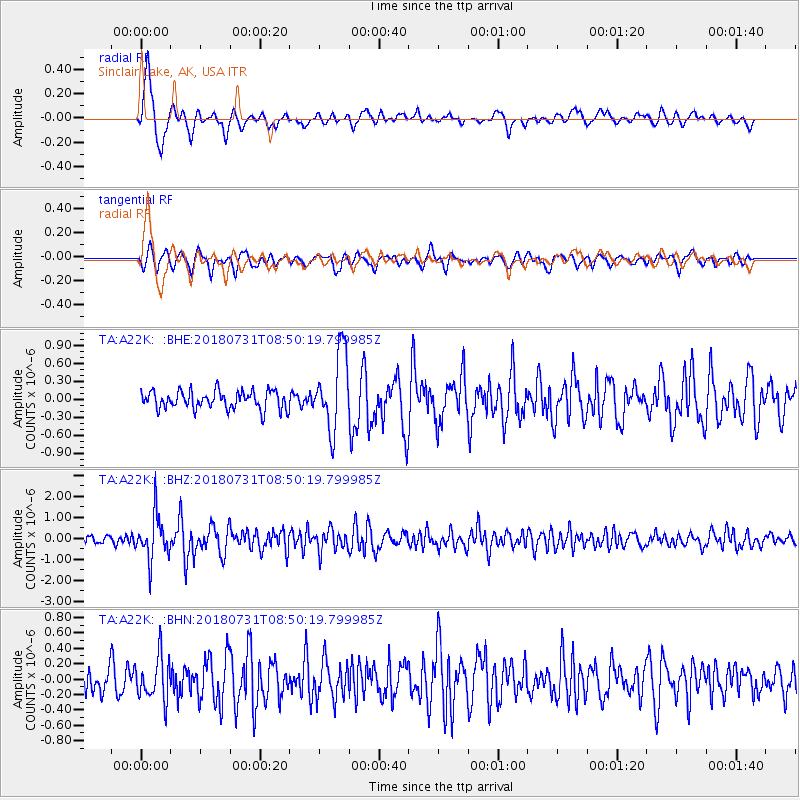
A22K Sinclair Lake, AK, USA - Earthquake Result Viewer
*The percent match for this event was below the threshold and hence no stack was calculated.
| Earthquake location: |
Near East Coast Of Honshu, Japan |
| Earthquake latitude/longitude: |
37.2/141.2 |
| Earthquake time(UTC): |
2018/07/31 (212) 08:42:20 GMT |
| Earthquake Depth: |
10 km |
| Earthquake Magnitude: |
5.4 Mww |
| Earthquake Catalog/Contributor: |
NEIC PDE/us |
|
| Network: |
TA USArray Transportable Network (new EarthScope stations) |
| Station: |
A22K Sinclair Lake, AK, USA |
| Lat/Lon: |
71.00 N/154.97 W |
| Elevation: |
6.0 m |
|
| Distance: |
46.9 deg |
| Az: |
23.757 deg |
| Baz: |
259.303 deg |
| Ray Param: |
$rayparam |
*The percent match for this event was below the threshold and hence was not used in the summary stack. |
|
| Radial Match: |
84.4161 % |
| Radial Bump: |
366 |
| Transverse Match: |
71.583305 % |
| Transverse Bump: |
400 |
| SOD ConfigId: |
13570011 |
| Insert Time: |
2019-04-30 16:58:29.593 +0000 |
| GWidth: |
2.5 |
| Max Bumps: |
400 |
| Tol: |
0.001 |
|
Signal To Noise
| Channel | StoN | STA | LTA |
| TA:A22K: :BHZ:20180731T08:50:19.799985Z | 4.9778104 | 1.055773E-6 | 2.1209587E-7 |
| TA:A22K: :BHN:20180731T08:50:19.799985Z | 1.7310141 | 2.787537E-7 | 1.610349E-7 |
| TA:A22K: :BHE:20180731T08:50:19.799985Z | 4.352142 | 6.463956E-7 | 1.4852357E-7 |
| Arrivals |
| Ps | |
| PpPs | |
| PsPs/PpSs | |


