You are here: Home > Network List > TA - USArray Transportable Network (new EarthScope stations) Stations List
> Station F21K Alatna River, AK, USA > Earthquake Result Viewer
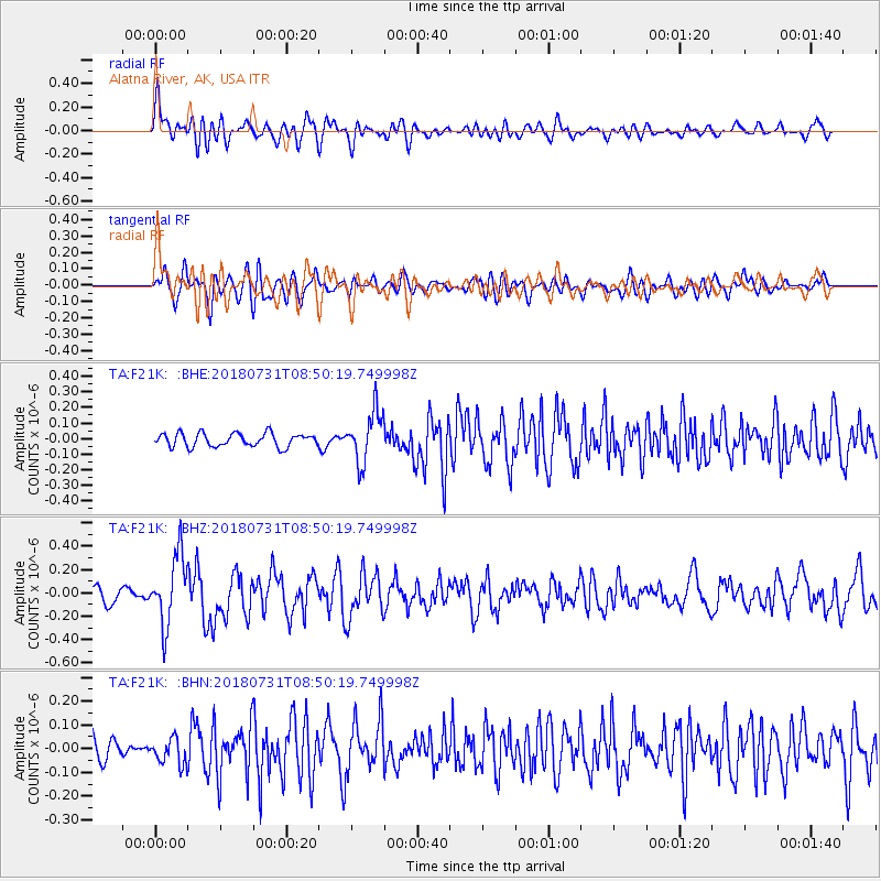
F21K Alatna River, AK, USA - Earthquake Result Viewer
*The percent match for this event was below the threshold and hence no stack was calculated.
| Earthquake location: |
Near East Coast Of Honshu, Japan |
| Earthquake latitude/longitude: |
37.2/141.2 |
| Earthquake time(UTC): |
2018/07/31 (212) 08:42:20 GMT |
| Earthquake Depth: |
10 km |
| Earthquake Magnitude: |
5.4 Mww |
| Earthquake Catalog/Contributor: |
NEIC PDE/us |
|
| Network: |
TA USArray Transportable Network (new EarthScope stations) |
| Station: |
F21K Alatna River, AK, USA |
| Lat/Lon: |
67.22 N/153.48 W |
| Elevation: |
597 m |
|
| Distance: |
46.9 deg |
| Az: |
29.017 deg |
| Baz: |
264.294 deg |
| Ray Param: |
$rayparam |
*The percent match for this event was below the threshold and hence was not used in the summary stack. |
|
| Radial Match: |
59.071144 % |
| Radial Bump: |
400 |
| Transverse Match: |
58.307182 % |
| Transverse Bump: |
400 |
| SOD ConfigId: |
13570011 |
| Insert Time: |
2019-04-30 16:59:03.899 +0000 |
| GWidth: |
2.5 |
| Max Bumps: |
400 |
| Tol: |
0.001 |
|
Signal To Noise
| Channel | StoN | STA | LTA |
| TA:F21K: :BHZ:20180731T08:50:19.749998Z | 5.380493 | 2.9361777E-7 | 5.4570794E-8 |
| TA:F21K: :BHN:20180731T08:50:19.749998Z | 0.91700375 | 5.4709975E-8 | 5.9661666E-8 |
| TA:F21K: :BHE:20180731T08:50:19.749998Z | 3.6758575 | 1.5766545E-7 | 4.2892157E-8 |
| Arrivals |
| Ps | |
| PpPs | |
| PsPs/PpSs | |


