You are here: Home > Network List > TA - USArray Transportable Network (new EarthScope stations) Stations List
> Station L15K Ungalak Mountain, AK, USA > Earthquake Result Viewer
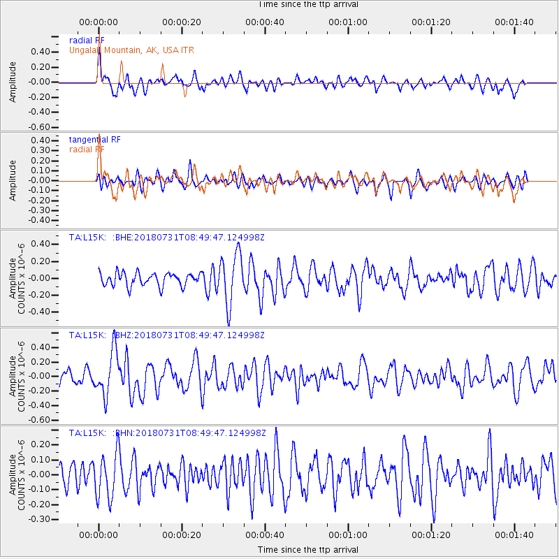
L15K Ungalak Mountain, AK, USA - Earthquake Result Viewer
*The percent match for this event was below the threshold and hence no stack was calculated.
| Earthquake location: |
Near East Coast Of Honshu, Japan |
| Earthquake latitude/longitude: |
37.2/141.2 |
| Earthquake time(UTC): |
2018/07/31 (212) 08:42:20 GMT |
| Earthquake Depth: |
10 km |
| Earthquake Magnitude: |
5.4 Mww |
| Earthquake Catalog/Contributor: |
NEIC PDE/us |
|
| Network: |
TA USArray Transportable Network (new EarthScope stations) |
| Station: |
L15K Ungalak Mountain, AK, USA |
| Lat/Lon: |
61.68 N/161.49 W |
| Elevation: |
219 m |
|
| Distance: |
42.7 deg |
| Az: |
36.269 deg |
| Baz: |
262.223 deg |
| Ray Param: |
$rayparam |
*The percent match for this event was below the threshold and hence was not used in the summary stack. |
|
| Radial Match: |
56.133945 % |
| Radial Bump: |
400 |
| Transverse Match: |
51.91463 % |
| Transverse Bump: |
400 |
| SOD ConfigId: |
13570011 |
| Insert Time: |
2019-04-30 16:59:54.637 +0000 |
| GWidth: |
2.5 |
| Max Bumps: |
400 |
| Tol: |
0.001 |
|
Signal To Noise
| Channel | StoN | STA | LTA |
| TA:L15K: :BHZ:20180731T08:49:47.124998Z | 1.901332 | 3.1554822E-7 | 1.6596167E-7 |
| TA:L15K: :BHN:20180731T08:49:47.124998Z | 1.9468244 | 1.5719878E-7 | 8.0746254E-8 |
| TA:L15K: :BHE:20180731T08:49:47.124998Z | 3.9598434 | 3.0292526E-7 | 7.64993E-8 |
| Arrivals |
| Ps | |
| PpPs | |
| PsPs/PpSs | |


