You are here: Home > Network List > G - GEOSCOPE Stations List
> Station MPG Montagne des Peres, French Guyana > Earthquake Result Viewer
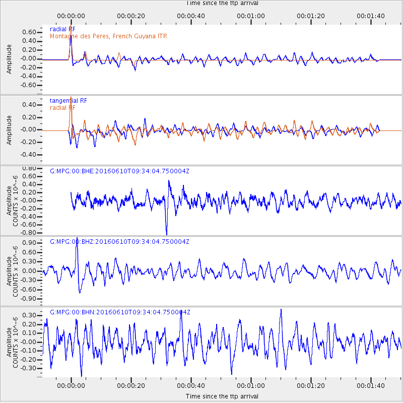
MPG Montagne des Peres, French Guyana - Earthquake Result Viewer
*The percent match for this event was below the threshold and hence no stack was calculated.
| Earthquake location: |
Ascension Island Region |
| Earthquake latitude/longitude: |
-7.5/-13.6 |
| Earthquake time(UTC): |
2016/06/10 (162) 09:26:53 GMT |
| Earthquake Depth: |
10 km |
| Earthquake Magnitude: |
5.5 MWP |
| Earthquake Catalog/Contributor: |
NEIC PDE/NEIC COMCAT |
|
| Network: |
G GEOSCOPE |
| Station: |
MPG Montagne des Peres, French Guyana |
| Lat/Lon: |
5.11 N/52.64 W |
| Elevation: |
147 m |
|
| Distance: |
40.9 deg |
| Az: |
286.627 deg |
| Baz: |
107.459 deg |
| Ray Param: |
$rayparam |
*The percent match for this event was below the threshold and hence was not used in the summary stack. |
|
| Radial Match: |
72.46351 % |
| Radial Bump: |
400 |
| Transverse Match: |
64.054306 % |
| Transverse Bump: |
400 |
| SOD ConfigId: |
1609551 |
| Insert Time: |
2016-06-24 09:28:22.676 +0000 |
| GWidth: |
2.5 |
| Max Bumps: |
400 |
| Tol: |
0.001 |
|
Signal To Noise
| Channel | StoN | STA | LTA |
| G:MPG:00:BHZ:20160610T09:34:04.750004Z | 2.865662 | 4.2405352E-7 | 1.479775E-7 |
| G:MPG:00:BHN:20160610T09:34:04.750004Z | 1.36047 | 1.5408231E-7 | 1.1325667E-7 |
| G:MPG:00:BHE:20160610T09:34:04.750004Z | 2.77541 | 2.9063585E-7 | 1.0471817E-7 |
| Arrivals |
| Ps | |
| PpPs | |
| PsPs/PpSs | |


