You are here: Home > Network List > TA - USArray Transportable Network (new EarthScope stations) Stations List
> Station O17K Koliganek, Bristol Bay, AK, USA > Earthquake Result Viewer
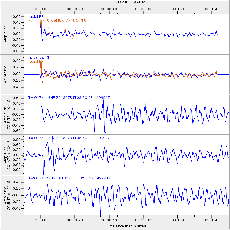
O17K Koliganek, Bristol Bay, AK, USA - Earthquake Result Viewer
*The percent match for this event was below the threshold and hence no stack was calculated.
| Earthquake location: |
Near East Coast Of Honshu, Japan |
| Earthquake latitude/longitude: |
37.2/141.2 |
| Earthquake time(UTC): |
2018/07/31 (212) 08:42:20 GMT |
| Earthquake Depth: |
10 km |
| Earthquake Magnitude: |
5.4 Mww |
| Earthquake Catalog/Contributor: |
NEIC PDE/us |
|
| Network: |
TA USArray Transportable Network (new EarthScope stations) |
| Station: |
O17K Koliganek, Bristol Bay, AK, USA |
| Lat/Lon: |
59.77 N/157.09 W |
| Elevation: |
156 m |
|
| Distance: |
44.7 deg |
| Az: |
39.282 deg |
| Baz: |
268.226 deg |
| Ray Param: |
$rayparam |
*The percent match for this event was below the threshold and hence was not used in the summary stack. |
|
| Radial Match: |
65.58216 % |
| Radial Bump: |
400 |
| Transverse Match: |
60.142727 % |
| Transverse Bump: |
400 |
| SOD ConfigId: |
13570011 |
| Insert Time: |
2019-04-30 17:00:26.113 +0000 |
| GWidth: |
2.5 |
| Max Bumps: |
400 |
| Tol: |
0.001 |
|
Signal To Noise
| Channel | StoN | STA | LTA |
| TA:O17K: :BHZ:20180731T08:50:03.149991Z | 4.215858 | 4.920105E-7 | 1.1670472E-7 |
| TA:O17K: :BHN:20180731T08:50:03.149991Z | 1.0182027 | 1.193419E-7 | 1.172084E-7 |
| TA:O17K: :BHE:20180731T08:50:03.149991Z | 2.120458 | 2.3638863E-7 | 1.1148E-7 |
| Arrivals |
| Ps | |
| PpPs | |
| PsPs/PpSs | |


