You are here: Home > Network List > GS - US Geological Survey Networks Stations List
> Station KAN10 Keim Farm > Earthquake Result Viewer
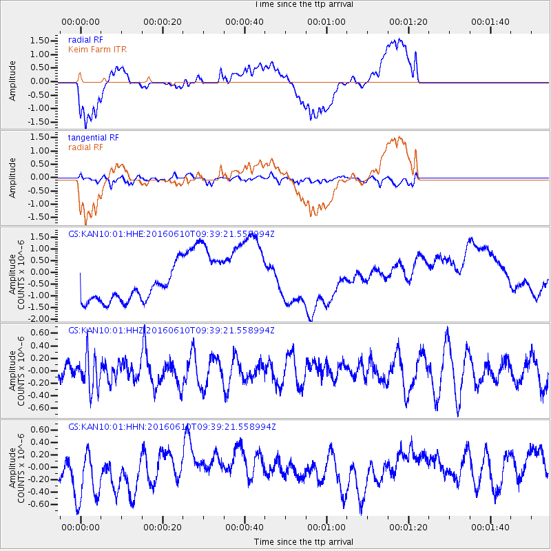
KAN10 Keim Farm - Earthquake Result Viewer
*The percent match for this event was below the threshold and hence no stack was calculated.
| Earthquake location: |
Ascension Island Region |
| Earthquake latitude/longitude: |
-7.5/-13.6 |
| Earthquake time(UTC): |
2016/06/10 (162) 09:26:53 GMT |
| Earthquake Depth: |
10 km |
| Earthquake Magnitude: |
5.5 MWP |
| Earthquake Catalog/Contributor: |
NEIC PDE/NEIC COMCAT |
|
| Network: |
GS US Geological Survey Networks |
| Station: |
KAN10 Keim Farm |
| Lat/Lon: |
37.12 N/98.10 W |
| Elevation: |
417 m |
|
| Distance: |
90.1 deg |
| Az: |
307.286 deg |
| Baz: |
99.208 deg |
| Ray Param: |
$rayparam |
*The percent match for this event was below the threshold and hence was not used in the summary stack. |
|
| Radial Match: |
29.151152 % |
| Radial Bump: |
400 |
| Transverse Match: |
65.61452 % |
| Transverse Bump: |
400 |
| SOD ConfigId: |
1609551 |
| Insert Time: |
2016-06-24 09:28:48.926 +0000 |
| GWidth: |
2.5 |
| Max Bumps: |
400 |
| Tol: |
0.001 |
|
Signal To Noise
| Channel | StoN | STA | LTA |
| GS:KAN10:01:HHZ:20160610T09:39:21.558994Z | 1.4836483 | 2.7410525E-7 | 1.8475082E-7 |
| GS:KAN10:01:HHN:20160610T09:39:21.558994Z | 2.1301444 | 5.095075E-7 | 2.391892E-7 |
| GS:KAN10:01:HHE:20160610T09:39:21.558994Z | 2.8189476 | 1.663513E-6 | 5.901185E-7 |
| Arrivals |
| Ps | |
| PpPs | |
| PsPs/PpSs | |


