You are here: Home > Network List > TA - USArray Transportable Network (new EarthScope stations) Stations List
> Station E18A Harlowton, MT, USA > Earthquake Result Viewer
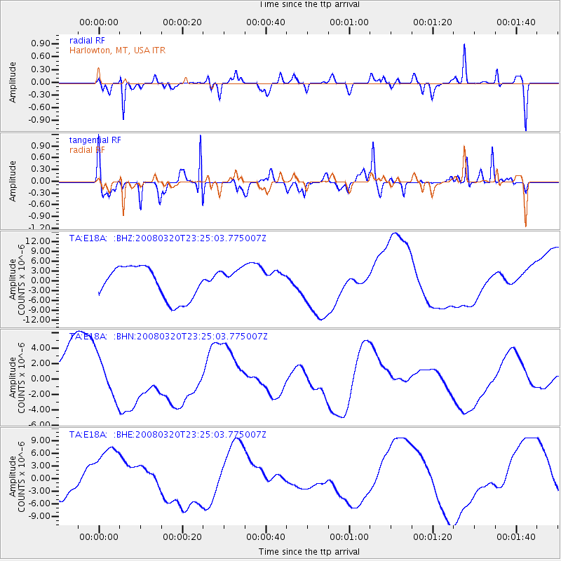
E18A Harlowton, MT, USA - Earthquake Result Viewer
*The percent match for this event was below the threshold and hence no stack was calculated.
| Earthquake location: |
Southern Xinjiang, China |
| Earthquake latitude/longitude: |
35.5/81.4 |
| Earthquake time(UTC): |
2008/03/20 (080) 23:12:00 GMT |
| Earthquake Depth: |
10 km |
| Earthquake Magnitude: |
5.6 MB |
| Earthquake Catalog/Contributor: |
WHDF/NEIC |
|
| Network: |
TA USArray Transportable Network (new EarthScope stations) |
| Station: |
E18A Harlowton, MT, USA |
| Lat/Lon: |
46.57 N/109.91 W |
| Elevation: |
1459 m |
|
| Distance: |
97.7 deg |
| Az: |
7.872 deg |
| Baz: |
350.68 deg |
| Ray Param: |
$rayparam |
*The percent match for this event was below the threshold and hence was not used in the summary stack. |
|
| Radial Match: |
67.136116 % |
| Radial Bump: |
400 |
| Transverse Match: |
65.416466 % |
| Transverse Bump: |
338 |
| SOD ConfigId: |
2504 |
| Insert Time: |
2010-03-06 13:21:10.062 +0000 |
| GWidth: |
2.5 |
| Max Bumps: |
400 |
| Tol: |
0.001 |
|
Signal To Noise
| Channel | StoN | STA | LTA |
| TA:E18A: :BHN:20080320T23:25:03.775007Z | 0.9410066 | 2.7202339E-6 | 2.8907702E-6 |
| TA:E18A: :BHE:20080320T23:25:03.775007Z | 2.1400046 | 7.5775088E-6 | 3.5408846E-6 |
| TA:E18A: :BHZ:20080320T23:25:03.775007Z | 0.76589763 | 3.7699178E-6 | 4.9222217E-6 |
| Arrivals |
| Ps | |
| PpPs | |
| PsPs/PpSs | |


