ULN Ulaanbaatar, Mongolia - Earthquake Result Viewer
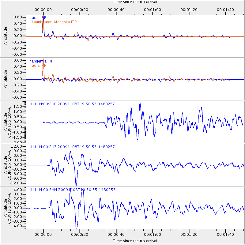
Earthquake location: Sumbawa Region, Indonesia
Earthquake latitude/longitude: -8.2/118.6
Earthquake time(UTC): 2009/11/08 (312) 19:41:43 GMT
Earthquake Depth: 18 km
Earthquake Magnitude: 6.3 MB, 6.5 MS, 6.6 MW, 6.5 MW
Earthquake Catalog/Contributor: WHDF/NEIC
Network: IU Global Seismograph Network (GSN - IRIS/USGS)
Station: ULN Ulaanbaatar, Mongolia
Lat/Lon: 47.87 N/107.05 E
Elevation: 1610 m
Distance: 56.8 deg
Az: 350.702 deg
Baz: 166.259 deg
Ray Param: 0.063911855
Estimated Moho Depth: 50.25 km
Estimated Crust Vp/Vs: 1.67
Assumed Crust Vp: 6.642 km/s
Estimated Crust Vs: 3.983 km/s
Estimated Crust Poisson's Ratio: 0.22
Radial Match: 97.8509 %
Radial Bump: 237
Transverse Match: 90.873055 %
Transverse Bump: 400
SOD ConfigId: 1
Insert Time: 2010-02-19 01:07:36.818 +0000
GWidth: 2.5
Max Bumps: 400
Tol: 0.001

Signal To Noise

ChannelStoNSTALTA
IU:ULN:00:BHZ:20091108T19:50:55.148025Z21.984771.3106305E-65.961539E-8
IU:ULN:00:BHN:20091108T19:50:55.148025Z13.1514346.1732095E-74.6939444E-8
IU:ULN:00:BHE:20091108T19:50:55.148025Z3.68978861.6143058E-74.375063E-8
Arrivals
Ps5.3 SECOND
PpPs19 SECOND
PsPs/PpSs24 SECOND