You are here: Home > Network List > TA - USArray Transportable Network (new EarthScope stations) Stations List
> Station G16K Koyuk River, AK, USA > Earthquake Result Viewer
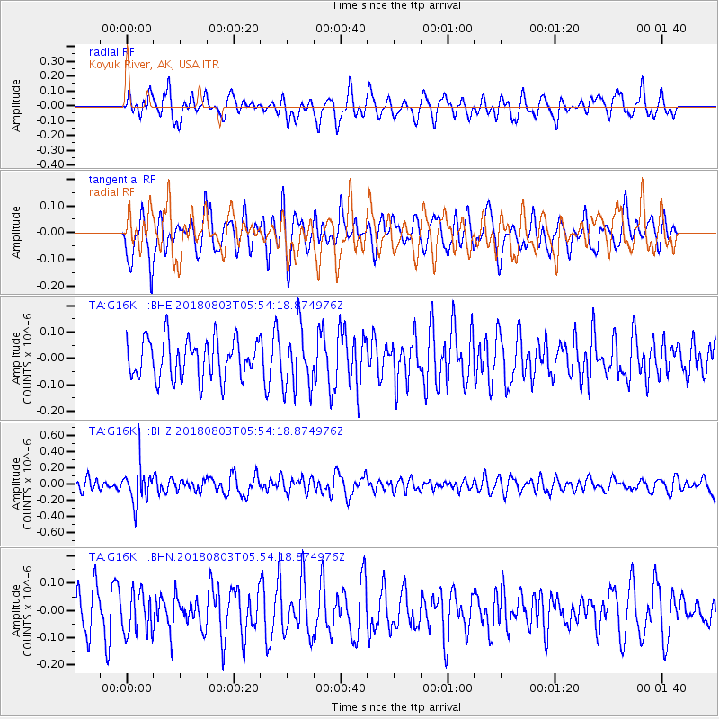
G16K Koyuk River, AK, USA - Earthquake Result Viewer
*The percent match for this event was below the threshold and hence no stack was calculated.
| Earthquake location: |
Tanimbar Islands Reg., Indonesia |
| Earthquake latitude/longitude: |
-6.2/132.7 |
| Earthquake time(UTC): |
2018/08/03 (215) 05:42:14 GMT |
| Earthquake Depth: |
28 km |
| Earthquake Magnitude: |
5.4 Mww |
| Earthquake Catalog/Contributor: |
NEIC PDE/us |
|
| Network: |
TA USArray Transportable Network (new EarthScope stations) |
| Station: |
G16K Koyuk River, AK, USA |
| Lat/Lon: |
65.39 N/162.35 W |
| Elevation: |
169 m |
|
| Distance: |
85.5 deg |
| Az: |
22.363 deg |
| Baz: |
244.615 deg |
| Ray Param: |
$rayparam |
*The percent match for this event was below the threshold and hence was not used in the summary stack. |
|
| Radial Match: |
46.492344 % |
| Radial Bump: |
400 |
| Transverse Match: |
53.574238 % |
| Transverse Bump: |
400 |
| SOD ConfigId: |
13570011 |
| Insert Time: |
2019-04-30 17:06:28.845 +0000 |
| GWidth: |
2.5 |
| Max Bumps: |
400 |
| Tol: |
0.001 |
|
Signal To Noise
| Channel | StoN | STA | LTA |
| TA:G16K: :BHZ:20180803T05:54:18.874976Z | 2.8037076 | 2.418623E-7 | 8.626517E-8 |
| TA:G16K: :BHN:20180803T05:54:18.874976Z | 1.0800709 | 7.59792E-8 | 7.0346495E-8 |
| TA:G16K: :BHE:20180803T05:54:18.874976Z | 1.5226558 | 1.13218675E-7 | 7.435605E-8 |
| Arrivals |
| Ps | |
| PpPs | |
| PsPs/PpSs | |


