You are here: Home > Network List > TA - USArray Transportable Network (new EarthScope stations) Stations List
> Station E18A Harlowton, MT, USA > Earthquake Result Viewer
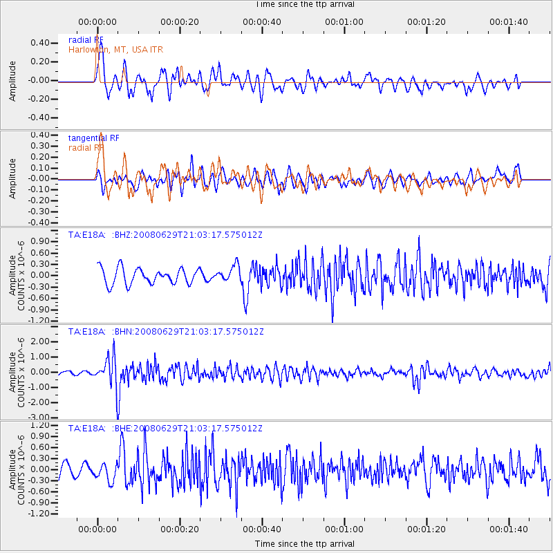
E18A Harlowton, MT, USA - Earthquake Result Viewer
*The percent match for this event was below the threshold and hence no stack was calculated.
| Earthquake location: |
Primor'ye, Russia |
| Earthquake latitude/longitude: |
45.2/137.4 |
| Earthquake time(UTC): |
2008/06/29 (181) 20:53:01 GMT |
| Earthquake Depth: |
287 km |
| Earthquake Magnitude: |
5.6 MB, 6.0 MW, 5.9 MW |
| Earthquake Catalog/Contributor: |
WHDF/NEIC |
|
| Network: |
TA USArray Transportable Network (new EarthScope stations) |
| Station: |
E18A Harlowton, MT, USA |
| Lat/Lon: |
46.57 N/109.91 W |
| Elevation: |
1459 m |
|
| Distance: |
71.1 deg |
| Az: |
42.287 deg |
| Baz: |
316.374 deg |
| Ray Param: |
$rayparam |
*The percent match for this event was below the threshold and hence was not used in the summary stack. |
|
| Radial Match: |
68.98573 % |
| Radial Bump: |
400 |
| Transverse Match: |
62.769466 % |
| Transverse Bump: |
400 |
| SOD ConfigId: |
2504 |
| Insert Time: |
2010-03-06 13:21:52.530 +0000 |
| GWidth: |
2.5 |
| Max Bumps: |
400 |
| Tol: |
0.001 |
|
Signal To Noise
| Channel | StoN | STA | LTA |
| TA:E18A: :BHN:20080629T21:03:17.575012Z | 8.5224085 | 9.776838E-7 | 1.1471919E-7 |
| TA:E18A: :BHE:20080629T21:03:17.575012Z | 1.0112183 | 2.319915E-7 | 2.2941785E-7 |
| TA:E18A: :BHZ:20080629T21:03:17.575012Z | 1.0478027 | 2.1897502E-7 | 2.0898499E-7 |
| Arrivals |
| Ps | |
| PpPs | |
| PsPs/PpSs | |


