You are here: Home > Network List > US - United States National Seismic Network Stations List
> Station CBKS Cedar Bluff, Kansas, USA > Earthquake Result Viewer
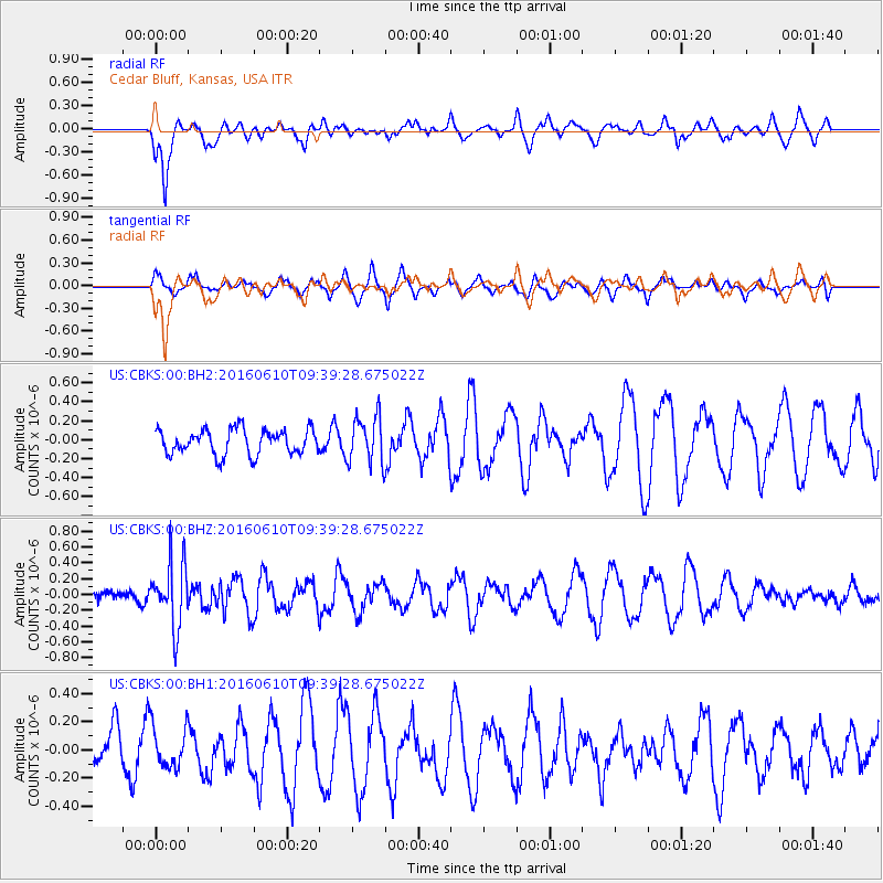
CBKS Cedar Bluff, Kansas, USA - Earthquake Result Viewer
*The percent match for this event was below the threshold and hence no stack was calculated.
| Earthquake location: |
Ascension Island Region |
| Earthquake latitude/longitude: |
-7.5/-13.6 |
| Earthquake time(UTC): |
2016/06/10 (162) 09:26:53 GMT |
| Earthquake Depth: |
10 km |
| Earthquake Magnitude: |
5.5 MWP |
| Earthquake Catalog/Contributor: |
NEIC PDE/NEIC COMCAT |
|
| Network: |
US United States National Seismic Network |
| Station: |
CBKS Cedar Bluff, Kansas, USA |
| Lat/Lon: |
38.81 N/99.74 W |
| Elevation: |
677 m |
|
| Distance: |
91.6 deg |
| Az: |
308.758 deg |
| Baz: |
98.179 deg |
| Ray Param: |
$rayparam |
*The percent match for this event was below the threshold and hence was not used in the summary stack. |
|
| Radial Match: |
67.408005 % |
| Radial Bump: |
400 |
| Transverse Match: |
61.237648 % |
| Transverse Bump: |
400 |
| SOD ConfigId: |
1609551 |
| Insert Time: |
2016-06-24 09:33:33.466 +0000 |
| GWidth: |
2.5 |
| Max Bumps: |
400 |
| Tol: |
0.001 |
|
Signal To Noise
| Channel | StoN | STA | LTA |
| US:CBKS:00:BHZ:20160610T09:39:28.675022Z | 3.3127198 | 4.1220795E-7 | 1.2443188E-7 |
| US:CBKS:00:BH1:20160610T09:39:28.675022Z | 0.9160047 | 1.469264E-7 | 1.6039917E-7 |
| US:CBKS:00:BH2:20160610T09:39:28.675022Z | 1.8938047 | 2.503442E-7 | 1.3219113E-7 |
| Arrivals |
| Ps | |
| PpPs | |
| PsPs/PpSs | |


