You are here: Home > Network List > TA - USArray Transportable Network (new EarthScope stations) Stations List
> Station M16K Timber Creek, AK, USA > Earthquake Result Viewer
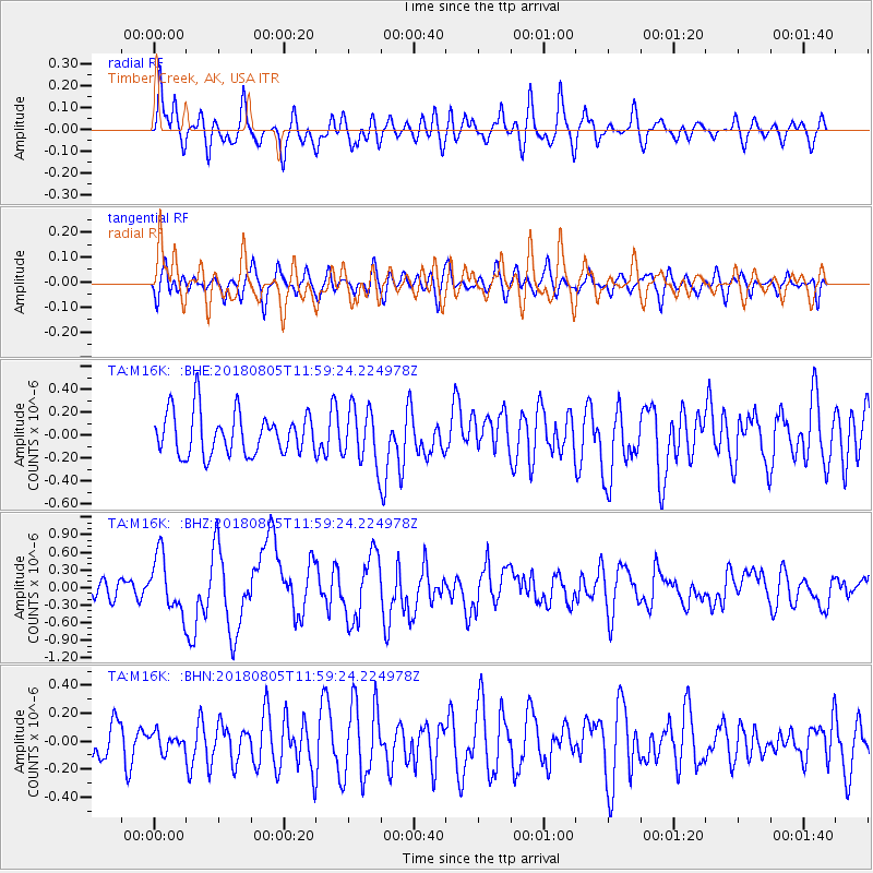
M16K Timber Creek, AK, USA - Earthquake Result Viewer
*The percent match for this event was below the threshold and hence no stack was calculated.
| Earthquake location: |
Sumbawa Region, Indonesia |
| Earthquake latitude/longitude: |
-8.3/116.5 |
| Earthquake time(UTC): |
2018/08/05 (217) 11:46:34 GMT |
| Earthquake Depth: |
10 km |
| Earthquake Magnitude: |
7.0 Mww |
| Earthquake Catalog/Contributor: |
NEIC PDE/us |
|
| Network: |
TA USArray Transportable Network (new EarthScope stations) |
| Station: |
M16K Timber Creek, AK, USA |
| Lat/Lon: |
61.02 N/158.96 W |
| Elevation: |
394 m |
|
| Distance: |
94.5 deg |
| Az: |
29.099 deg |
| Baz: |
261.278 deg |
| Ray Param: |
$rayparam |
*The percent match for this event was below the threshold and hence was not used in the summary stack. |
|
| Radial Match: |
65.95804 % |
| Radial Bump: |
400 |
| Transverse Match: |
58.184837 % |
| Transverse Bump: |
400 |
| SOD ConfigId: |
13570011 |
| Insert Time: |
2019-04-30 17:23:27.984 +0000 |
| GWidth: |
2.5 |
| Max Bumps: |
400 |
| Tol: |
0.001 |
|
Signal To Noise
| Channel | StoN | STA | LTA |
| TA:M16K: :BHZ:20180805T11:59:24.224978Z | 4.17098 | 4.797917E-7 | 1.1503093E-7 |
| TA:M16K: :BHN:20180805T11:59:24.224978Z | 0.39079124 | 6.2847285E-8 | 1.6082062E-7 |
| TA:M16K: :BHE:20180805T11:59:24.224978Z | 1.1169063 | 2.0684993E-7 | 1.85199E-7 |
| Arrivals |
| Ps | |
| PpPs | |
| PsPs/PpSs | |


