You are here: Home > Network List > IW - Intermountain West Stations List
> Station MOOW Moose Ponds, Wyoming, USA > Earthquake Result Viewer
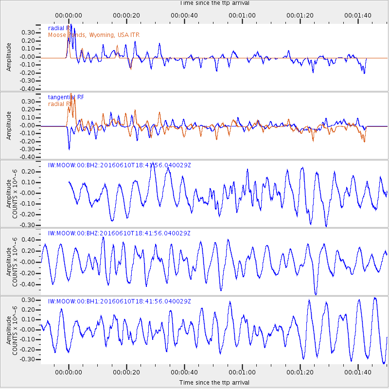
MOOW Moose Ponds, Wyoming, USA - Earthquake Result Viewer
*The percent match for this event was below the threshold and hence no stack was calculated.
| Earthquake location: |
Fiji Islands Region |
| Earthquake latitude/longitude: |
-16.5/-177.2 |
| Earthquake time(UTC): |
2016/06/10 (162) 18:29:50 GMT |
| Earthquake Depth: |
10 km |
| Earthquake Magnitude: |
5.7 MB, 5.5 MS_20, 5.8 MWW |
| Earthquake Catalog/Contributor: |
NEIC PDE/NEIC COMCAT |
|
| Network: |
IW Intermountain West |
| Station: |
MOOW Moose Ponds, Wyoming, USA |
| Lat/Lon: |
43.75 N/110.74 W |
| Elevation: |
2128 m |
|
| Distance: |
85.3 deg |
| Az: |
41.826 deg |
| Baz: |
241.976 deg |
| Ray Param: |
$rayparam |
*The percent match for this event was below the threshold and hence was not used in the summary stack. |
|
| Radial Match: |
70.08558 % |
| Radial Bump: |
400 |
| Transverse Match: |
47.9649 % |
| Transverse Bump: |
400 |
| SOD ConfigId: |
1609551 |
| Insert Time: |
2016-06-24 18:30:57.373 +0000 |
| GWidth: |
2.5 |
| Max Bumps: |
400 |
| Tol: |
0.001 |
|
Signal To Noise
| Channel | StoN | STA | LTA |
| IW:MOOW:00:BHZ:20160610T18:41:56.040029Z | 1.370368 | 1.960442E-7 | 1.4305952E-7 |
| IW:MOOW:00:BH1:20160610T18:41:56.040029Z | 1.7124594 | 1.164999E-7 | 6.803075E-8 |
| IW:MOOW:00:BH2:20160610T18:41:56.040029Z | 1.7950608 | 1.8038395E-7 | 1.00489046E-7 |
| Arrivals |
| Ps | |
| PpPs | |
| PsPs/PpSs | |


