You are here: Home > Network List > CI - Caltech Regional Seismic Network Stations List
> Station MPM Manuel Prospect Mine, California, USA > Earthquake Result Viewer
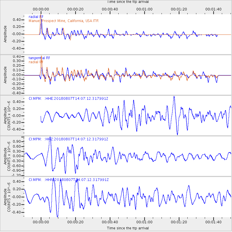
MPM Manuel Prospect Mine, California, USA - Earthquake Result Viewer
*The percent match for this event was below the threshold and hence no stack was calculated.
| Earthquake location: |
Greenland Sea |
| Earthquake latitude/longitude: |
74.6/8.4 |
| Earthquake time(UTC): |
2018/08/07 (219) 13:57:09 GMT |
| Earthquake Depth: |
10 km |
| Earthquake Magnitude: |
5.8 Mww |
| Earthquake Catalog/Contributor: |
NEIC PDE/us |
|
| Network: |
CI Caltech Regional Seismic Network |
| Station: |
MPM Manuel Prospect Mine, California, USA |
| Lat/Lon: |
36.06 N/117.49 W |
| Elevation: |
185 m |
|
| Distance: |
64.0 deg |
| Az: |
313.086 deg |
| Baz: |
13.907 deg |
| Ray Param: |
$rayparam |
*The percent match for this event was below the threshold and hence was not used in the summary stack. |
|
| Radial Match: |
72.38646 % |
| Radial Bump: |
400 |
| Transverse Match: |
78.1111 % |
| Transverse Bump: |
400 |
| SOD ConfigId: |
13570011 |
| Insert Time: |
2019-04-30 17:30:15.662 +0000 |
| GWidth: |
2.5 |
| Max Bumps: |
400 |
| Tol: |
0.001 |
|
Signal To Noise
| Channel | StoN | STA | LTA |
| CI:MPM: :HHZ:20180807T14:07:12.317991Z | 3.0290625 | 3.323302E-7 | 1.0971388E-7 |
| CI:MPM: :HHN:20180807T14:07:12.317991Z | 0.6151905 | 5.806564E-8 | 9.4386436E-8 |
| CI:MPM: :HHE:20180807T14:07:12.317991Z | 0.8953712 | 7.419338E-8 | 8.286327E-8 |
| Arrivals |
| Ps | |
| PpPs | |
| PsPs/PpSs | |


