You are here: Home > Network List > GS - US Geological Survey Networks Stations List
> Station KAN10 Keim Farm > Earthquake Result Viewer
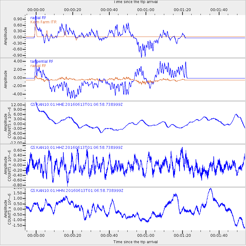
KAN10 Keim Farm - Earthquake Result Viewer
*The percent match for this event was below the threshold and hence no stack was calculated.
| Earthquake location: |
Central East Pacific Rise |
| Earthquake latitude/longitude: |
-4.4/-104.8 |
| Earthquake time(UTC): |
2016/06/13 (165) 00:59:39 GMT |
| Earthquake Depth: |
10 km |
| Earthquake Magnitude: |
5.7 MWW, 5.6 MWB, 5.7 MWC |
| Earthquake Catalog/Contributor: |
NEIC PDE/NEIC COMCAT |
|
| Network: |
GS US Geological Survey Networks |
| Station: |
KAN10 Keim Farm |
| Lat/Lon: |
37.12 N/98.10 W |
| Elevation: |
417 m |
|
| Distance: |
41.8 deg |
| Az: |
8.06 deg |
| Baz: |
190.073 deg |
| Ray Param: |
$rayparam |
*The percent match for this event was below the threshold and hence was not used in the summary stack. |
|
| Radial Match: |
55.868828 % |
| Radial Bump: |
384 |
| Transverse Match: |
83.29355 % |
| Transverse Bump: |
400 |
| SOD ConfigId: |
1609551 |
| Insert Time: |
2016-06-27 01:00:23.076 +0000 |
| GWidth: |
2.5 |
| Max Bumps: |
400 |
| Tol: |
0.001 |
|
Signal To Noise
| Channel | StoN | STA | LTA |
| GS:KAN10:01:HHZ:20160613T01:06:58.738999Z | 1.0284089 | 1.8727742E-7 | 1.8210403E-7 |
| GS:KAN10:01:HHN:20160613T01:06:58.738999Z | 0.8923409 | 1.364492E-6 | 1.5291153E-6 |
| GS:KAN10:01:HHE:20160613T01:06:58.738999Z | 1.7063754 | 5.78933E-6 | 3.3927647E-6 |
| Arrivals |
| Ps | |
| PpPs | |
| PsPs/PpSs | |


