You are here: Home > Network List > CI - Caltech Regional Seismic Network Stations List
> Station PHL Parkhill, California, USA > Earthquake Result Viewer
PHL Parkhill, California, USA - Earthquake Result Viewer

| Earthquake location: |
Catamarca Province, Argentina |
| Earthquake latitude/longitude: |
-28.9/-66.8 |
| Earthquake time(UTC): |
2002/05/28 (148) 04:04:22 GMT |
| Earthquake Depth: |
22 km |
| Earthquake Magnitude: |
6.0 MB, 5.7 MS, 6.0 MW, 5.9 MW |
| Earthquake Catalog/Contributor: |
WHDF/NEIC |
|
| Network: |
CI Caltech Regional Seismic Network |
| Station: |
PHL Parkhill, California, USA |
| Lat/Lon: |
35.41 N/120.55 W |
| Elevation: |
351 m |
|
| Distance: |
81.6 deg |
| Az: |
318.251 deg |
| Baz: |
134.399 deg |
| Ray Param: |
0.04743627 |
| Estimated Moho Depth: |
31.0 km |
| Estimated Crust Vp/Vs: |
1.60 |
| Assumed Crust Vp: |
6.183 km/s |
| Estimated Crust Vs: |
3.858 km/s |
| Estimated Crust Poisson's Ratio: |
0.18 |
|
| Radial Match: |
89.21341 % |
| Radial Bump: |
400 |
| Transverse Match: |
73.332275 % |
| Transverse Bump: |
400 |
| SOD ConfigId: |
3787 |
| Insert Time: |
2010-02-26 02:08:08.839 +0000 |
| GWidth: |
2.5 |
| Max Bumps: |
400 |
| Tol: |
0.001 |
|
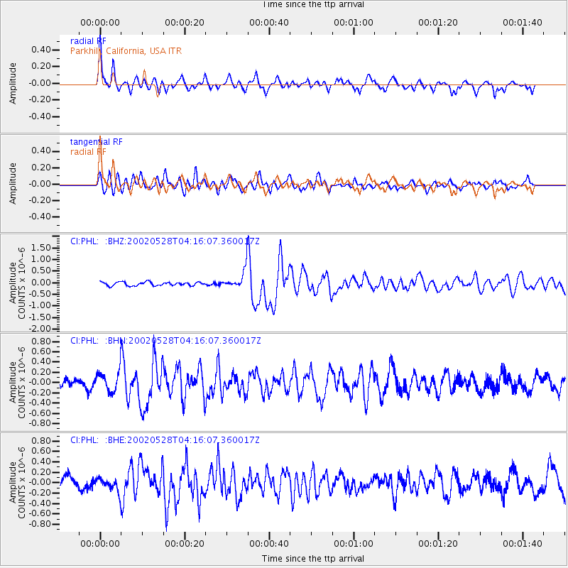
Signal To Noise
| Channel | StoN | STA | LTA |
| CI:PHL: :BHN:20020528T04:16:07.360017Z | 2.180587 | 2.0735446E-7 | 9.509112E-8 |
| CI:PHL: :BHE:20020528T04:16:07.360017Z | 1.164824 | 1.3460324E-7 | 1.1555672E-7 |
| CI:PHL: :BHZ:20020528T04:16:07.360017Z | 5.6038585 | 4.349145E-7 | 7.760983E-8 |
| Arrivals |
| Ps | 3.1 SECOND |
| PpPs | 13 SECOND |
| PsPs/PpSs | 16 SECOND |


