You are here: Home > Network List > TA - USArray Transportable Network (new EarthScope stations) Stations List
> Station D23K Nanushuk River, AK USA > Earthquake Result Viewer
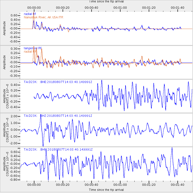
D23K Nanushuk River, AK USA - Earthquake Result Viewer
*The percent match for this event was below the threshold and hence no stack was calculated.
| Earthquake location: |
Greenland Sea |
| Earthquake latitude/longitude: |
74.6/8.4 |
| Earthquake time(UTC): |
2018/08/07 (219) 13:57:09 GMT |
| Earthquake Depth: |
10 km |
| Earthquake Magnitude: |
5.8 Mww |
| Earthquake Catalog/Contributor: |
NEIC PDE/us |
|
| Network: |
TA USArray Transportable Network (new EarthScope stations) |
| Station: |
D23K Nanushuk River, AK USA |
| Lat/Lon: |
68.97 N/150.68 W |
| Elevation: |
406 m |
|
| Distance: |
36.0 deg |
| Az: |
347.334 deg |
| Baz: |
9.32 deg |
| Ray Param: |
$rayparam |
*The percent match for this event was below the threshold and hence was not used in the summary stack. |
|
| Radial Match: |
72.86257 % |
| Radial Bump: |
400 |
| Transverse Match: |
68.444824 % |
| Transverse Bump: |
400 |
| SOD ConfigId: |
13570011 |
| Insert Time: |
2019-04-30 17:37:21.297 +0000 |
| GWidth: |
2.5 |
| Max Bumps: |
400 |
| Tol: |
0.001 |
|
Signal To Noise
| Channel | StoN | STA | LTA |
| TA:D23K: :BHZ:20180807T14:03:40.149991Z | 6.5789037 | 7.790938E-7 | 1.18423046E-7 |
| TA:D23K: :BHN:20180807T14:03:40.149991Z | 2.5733685 | 1.4853661E-7 | 5.7720698E-8 |
| TA:D23K: :BHE:20180807T14:03:40.149991Z | 1.2143797 | 7.5281164E-8 | 6.199146E-8 |
| Arrivals |
| Ps | |
| PpPs | |
| PsPs/PpSs | |


