You are here: Home > Network List > TA - USArray Transportable Network (new EarthScope stations) Stations List
> Station H16K Elim, AK, USA > Earthquake Result Viewer
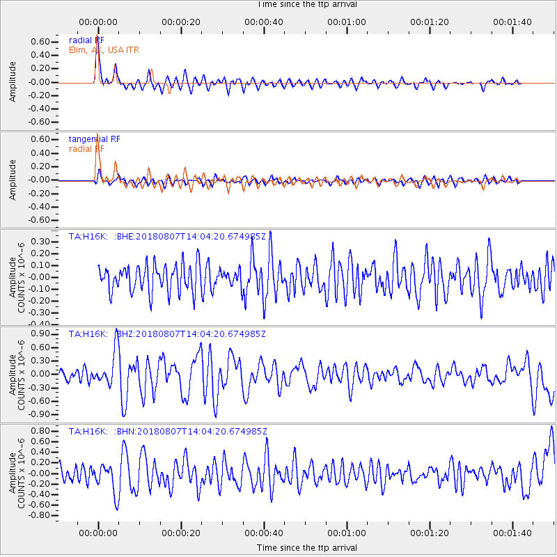
H16K Elim, AK, USA - Earthquake Result Viewer
*The percent match for this event was below the threshold and hence no stack was calculated.
| Earthquake location: |
Greenland Sea |
| Earthquake latitude/longitude: |
74.6/8.4 |
| Earthquake time(UTC): |
2018/08/07 (219) 13:57:09 GMT |
| Earthquake Depth: |
10 km |
| Earthquake Magnitude: |
5.8 Mww |
| Earthquake Catalog/Contributor: |
NEIC PDE/us |
|
| Network: |
TA USArray Transportable Network (new EarthScope stations) |
| Station: |
H16K Elim, AK, USA |
| Lat/Lon: |
64.64 N/162.24 W |
| Elevation: |
216 m |
|
| Distance: |
40.8 deg |
| Az: |
353.849 deg |
| Baz: |
3.804 deg |
| Ray Param: |
$rayparam |
*The percent match for this event was below the threshold and hence was not used in the summary stack. |
|
| Radial Match: |
79.57875 % |
| Radial Bump: |
400 |
| Transverse Match: |
67.45911 % |
| Transverse Bump: |
400 |
| SOD ConfigId: |
13570011 |
| Insert Time: |
2019-04-30 17:37:55.116 +0000 |
| GWidth: |
2.5 |
| Max Bumps: |
400 |
| Tol: |
0.001 |
|
Signal To Noise
| Channel | StoN | STA | LTA |
| TA:H16K: :BHZ:20180807T14:04:20.674985Z | 3.6284592 | 4.109267E-7 | 1.1325101E-7 |
| TA:H16K: :BHN:20180807T14:04:20.674985Z | 2.3932931 | 2.8553282E-7 | 1.1930541E-7 |
| TA:H16K: :BHE:20180807T14:04:20.674985Z | 0.60261595 | 6.724339E-8 | 1.1158582E-7 |
| Arrivals |
| Ps | |
| PpPs | |
| PsPs/PpSs | |


