You are here: Home > Network List > TA - USArray Transportable Network (new EarthScope stations) Stations List
> Station MDND Maddock, ND, USA > Earthquake Result Viewer
MDND Maddock, ND, USA - Earthquake Result Viewer
*The percent match for this event was below the threshold and hence no stack was calculated.
| Earthquake location: |
Greenland Sea |
| Earthquake latitude/longitude: |
74.6/8.4 |
| Earthquake time(UTC): |
2018/08/07 (219) 13:57:09 GMT |
| Earthquake Depth: |
10 km |
| Earthquake Magnitude: |
5.8 Mww |
| Earthquake Catalog/Contributor: |
NEIC PDE/us |
|
| Network: |
TA USArray Transportable Network (new EarthScope stations) |
| Station: |
MDND Maddock, ND, USA |
| Lat/Lon: |
47.85 N/99.60 W |
| Elevation: |
479 m |
|
| Distance: |
48.9 deg |
| Az: |
301.833 deg |
| Baz: |
19.655 deg |
| Ray Param: |
$rayparam |
*The percent match for this event was below the threshold and hence was not used in the summary stack. |
|
| Radial Match: |
51.871872 % |
| Radial Bump: |
346 |
| Transverse Match: |
46.0752 % |
| Transverse Bump: |
400 |
| SOD ConfigId: |
13570011 |
| Insert Time: |
2019-04-30 17:38:50.344 +0000 |
| GWidth: |
2.5 |
| Max Bumps: |
400 |
| Tol: |
0.001 |
|
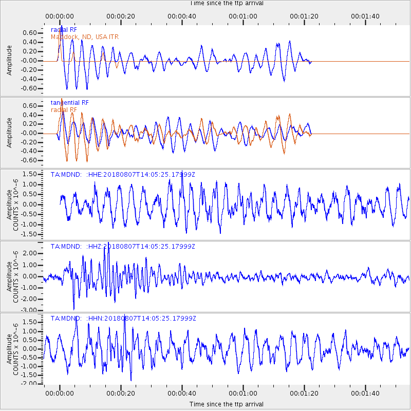
Signal To Noise
| Channel | StoN | STA | LTA |
| TA:MDND: :HHZ:20180807T14:05:25.17999Z | 5.3666563 | 8.529269E-7 | 1.5893079E-7 |
| TA:MDND: :HHN:20180807T14:05:25.17999Z | 1.0265 | 6.45716E-7 | 6.290463E-7 |
| TA:MDND: :HHE:20180807T14:05:25.17999Z | 0.8563939 | 4.659042E-7 | 5.440303E-7 |
| Arrivals |
| Ps | |
| PpPs | |
| PsPs/PpSs | |


