You are here: Home > Network List > CI - Caltech Regional Seismic Network Stations List
> Station PHL Parkhill, California, USA > Earthquake Result Viewer
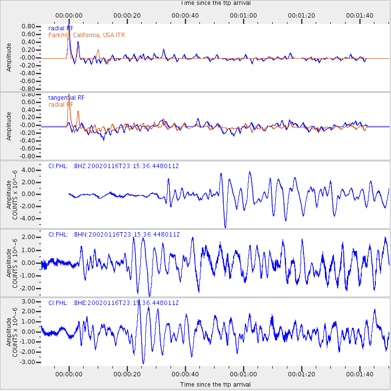
PHL Parkhill, California, USA - Earthquake Result Viewer

| Earthquake location: |
Near Coast Of Chiapas, Mexico |
| Earthquake latitude/longitude: |
15.5/-93.1 |
| Earthquake time(UTC): |
2002/01/16 (016) 23:09:52 GMT |
| Earthquake Depth: |
80 km |
| Earthquake Magnitude: |
5.8 MB, 6.4 MW, 6.4 MW |
| Earthquake Catalog/Contributor: |
WHDF/NEIC |
|
| Network: |
CI Caltech Regional Seismic Network |
| Station: |
PHL Parkhill, California, USA |
| Lat/Lon: |
35.41 N/120.55 W |
| Elevation: |
351 m |
|
| Distance: |
31.5 deg |
| Az: |
314.024 deg |
| Baz: |
121.938 deg |
| Ray Param: |
0.07883581 |
| Estimated Moho Depth: |
25.25 km |
| Estimated Crust Vp/Vs: |
1.75 |
| Assumed Crust Vp: |
6.183 km/s |
| Estimated Crust Vs: |
3.533 km/s |
| Estimated Crust Poisson's Ratio: |
0.26 |
|
| Radial Match: |
85.6824 % |
| Radial Bump: |
400 |
| Transverse Match: |
48.86962 % |
| Transverse Bump: |
400 |
| SOD ConfigId: |
3787 |
| Insert Time: |
2010-02-26 02:08:15.179 +0000 |
| GWidth: |
2.5 |
| Max Bumps: |
400 |
| Tol: |
0.001 |
|
Signal To Noise
| Channel | StoN | STA | LTA |
| CI:PHL: :BHN:20020116T23:15:36.448011Z | 1.421999 | 5.541612E-7 | 3.8970578E-7 |
| CI:PHL: :BHE:20020116T23:15:36.448011Z | 1.6936299 | 5.188497E-7 | 3.0635363E-7 |
| CI:PHL: :BHZ:20020116T23:15:36.448011Z | 4.531247 | 9.126207E-7 | 2.0140607E-7 |
| Arrivals |
| Ps | 3.3 SECOND |
| PpPs | 10 SECOND |
| PsPs/PpSs | 14 SECOND |


