You are here: Home > Network List > US - United States National Seismic Network Stations List
> Station MSO Missoula, Montana, USA > Earthquake Result Viewer
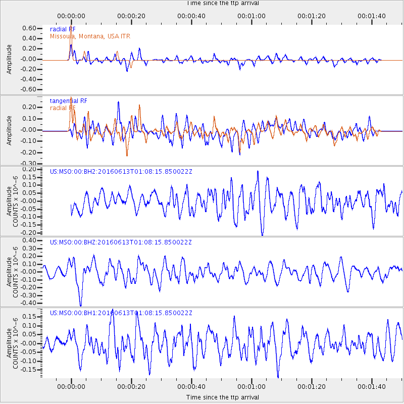
MSO Missoula, Montana, USA - Earthquake Result Viewer
*The percent match for this event was below the threshold and hence no stack was calculated.
| Earthquake location: |
Central East Pacific Rise |
| Earthquake latitude/longitude: |
-4.4/-104.8 |
| Earthquake time(UTC): |
2016/06/13 (165) 00:59:39 GMT |
| Earthquake Depth: |
10 km |
| Earthquake Magnitude: |
5.7 MWW, 5.6 MWB, 5.7 MWC |
| Earthquake Catalog/Contributor: |
NEIC PDE/NEIC COMCAT |
|
| Network: |
US United States National Seismic Network |
| Station: |
MSO Missoula, Montana, USA |
| Lat/Lon: |
46.83 N/113.94 W |
| Elevation: |
1264 m |
|
| Distance: |
51.7 deg |
| Az: |
352.017 deg |
| Baz: |
168.366 deg |
| Ray Param: |
$rayparam |
*The percent match for this event was below the threshold and hence was not used in the summary stack. |
|
| Radial Match: |
63.250637 % |
| Radial Bump: |
400 |
| Transverse Match: |
60.30436 % |
| Transverse Bump: |
400 |
| SOD ConfigId: |
1609551 |
| Insert Time: |
2016-06-27 01:04:17.486 +0000 |
| GWidth: |
2.5 |
| Max Bumps: |
400 |
| Tol: |
0.001 |
|
Signal To Noise
| Channel | StoN | STA | LTA |
| US:MSO:00:BHZ:20160613T01:08:15.850022Z | 4.26726 | 1.9787899E-7 | 4.637144E-8 |
| US:MSO:00:BH1:20160613T01:08:15.850022Z | 1.4654177 | 6.8866655E-8 | 4.6994554E-8 |
| US:MSO:00:BH2:20160613T01:08:15.850022Z | 1.0365447 | 4.8333373E-8 | 4.6629317E-8 |
| Arrivals |
| Ps | |
| PpPs | |
| PsPs/PpSs | |


