You are here: Home > Network List > CN - Canadian National Seismograph Network Stations List
> Station INK INUVIK, NT > Earthquake Result Viewer
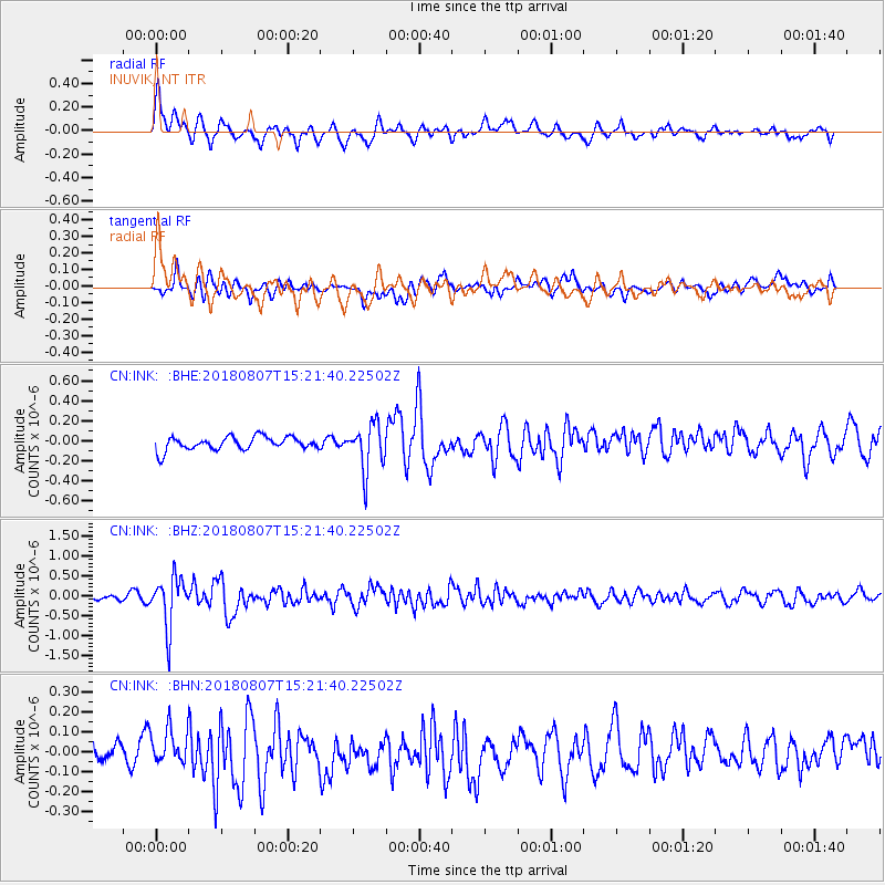
INK INUVIK, NT - Earthquake Result Viewer
*The percent match for this event was below the threshold and hence no stack was calculated.
| Earthquake location: |
Off East Coast Of Honshu, Japan |
| Earthquake latitude/longitude: |
37.9/144.1 |
| Earthquake time(UTC): |
2018/08/07 (219) 15:12:57 GMT |
| Earthquake Depth: |
12 km |
| Earthquake Magnitude: |
5.6 Mww |
| Earthquake Catalog/Contributor: |
NEIC PDE/us |
|
| Network: |
CN Canadian National Seismograph Network |
| Station: |
INK INUVIK, NT |
| Lat/Lon: |
68.31 N/133.53 W |
| Elevation: |
44 m |
|
| Distance: |
52.7 deg |
| Az: |
27.612 deg |
| Baz: |
279.433 deg |
| Ray Param: |
$rayparam |
*The percent match for this event was below the threshold and hence was not used in the summary stack. |
|
| Radial Match: |
77.669815 % |
| Radial Bump: |
400 |
| Transverse Match: |
69.31753 % |
| Transverse Bump: |
400 |
| SOD ConfigId: |
13570011 |
| Insert Time: |
2019-04-30 17:46:33.453 +0000 |
| GWidth: |
2.5 |
| Max Bumps: |
400 |
| Tol: |
0.001 |
|
Signal To Noise
| Channel | StoN | STA | LTA |
| CN:INK: :BHZ:20180807T15:21:40.22502Z | 5.4737062 | 6.172214E-7 | 1.1276116E-7 |
| CN:INK: :BHN:20180807T15:21:40.22502Z | 1.4404095 | 7.95171E-8 | 5.5204506E-8 |
| CN:INK: :BHE:20180807T15:21:40.22502Z | 3.507245 | 2.30673E-7 | 6.577042E-8 |
| Arrivals |
| Ps | |
| PpPs | |
| PsPs/PpSs | |


