You are here: Home > Network List > CI - Caltech Regional Seismic Network Stations List
> Station PHL Parkhill, California, USA > Earthquake Result Viewer
PHL Parkhill, California, USA - Earthquake Result Viewer

| Earthquake location: |
Andreanof Islands, Aleutian Is. |
| Earthquake latitude/longitude: |
51.4/-179.5 |
| Earthquake time(UTC): |
2007/12/19 (353) 09:30:27 GMT |
| Earthquake Depth: |
29 km |
| Earthquake Magnitude: |
6.4 MB, 7.1 MS, 7.1 MW, 7.0 MW |
| Earthquake Catalog/Contributor: |
WHDF/NEIC |
|
| Network: |
CI Caltech Regional Seismic Network |
| Station: |
PHL Parkhill, California, USA |
| Lat/Lon: |
35.41 N/120.55 W |
| Elevation: |
351 m |
|
| Distance: |
44.5 deg |
| Az: |
87.249 deg |
| Baz: |
309.95 deg |
| Ray Param: |
0.07182886 |
| Estimated Moho Depth: |
45.75 km |
| Estimated Crust Vp/Vs: |
1.98 |
| Assumed Crust Vp: |
6.183 km/s |
| Estimated Crust Vs: |
3.126 km/s |
| Estimated Crust Poisson's Ratio: |
0.33 |
|
| Radial Match: |
88.06802 % |
| Radial Bump: |
383 |
| Transverse Match: |
81.47994 % |
| Transverse Bump: |
400 |
| SOD ConfigId: |
2564 |
| Insert Time: |
2010-02-26 02:08:33.406 +0000 |
| GWidth: |
2.5 |
| Max Bumps: |
400 |
| Tol: |
0.001 |
|
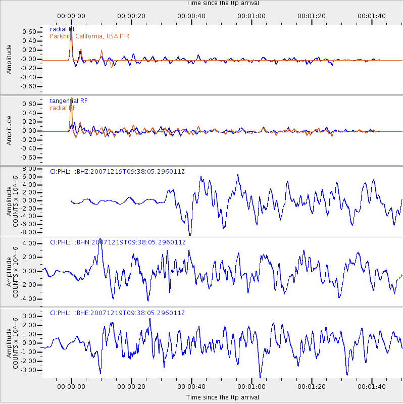
Signal To Noise
| Channel | StoN | STA | LTA |
| CI:PHL: :BHN:20071219T09:38:05.296011Z | 1.5028619 | 6.8350835E-7 | 4.548045E-7 |
| CI:PHL: :BHE:20071219T09:38:05.296011Z | 0.9884941 | 4.1540432E-7 | 4.2023956E-7 |
| CI:PHL: :BHZ:20071219T09:38:05.296011Z | 3.8850265 | 1.786022E-6 | 4.5971942E-7 |
| Arrivals |
| Ps | 7.6 SECOND |
| PpPs | 21 SECOND |
| PsPs/PpSs | 29 SECOND |


