You are here: Home > Network List > TA - USArray Transportable Network (new EarthScope stations) Stations List
> Station L15A Malad City, ID, USA > Earthquake Result Viewer
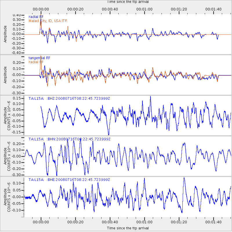
L15A Malad City, ID, USA - Earthquake Result Viewer
*The percent match for this event was below the threshold and hence no stack was calculated.
| Earthquake location: |
Samoa Islands Region |
| Earthquake latitude/longitude: |
-16.6/-173.0 |
| Earthquake time(UTC): |
2008/07/16 (198) 08:11:04 GMT |
| Earthquake Depth: |
10 km |
| Earthquake Magnitude: |
5.5 MB, 5.4 MS, 5.7 MW, 5.7 MW |
| Earthquake Catalog/Contributor: |
WHDF/NEIC |
|
| Network: |
TA USArray Transportable Network (new EarthScope stations) |
| Station: |
L15A Malad City, ID, USA |
| Lat/Lon: |
42.00 N/112.39 W |
| Elevation: |
1646 m |
|
| Distance: |
80.7 deg |
| Az: |
41.137 deg |
| Baz: |
237.814 deg |
| Ray Param: |
$rayparam |
*The percent match for this event was below the threshold and hence was not used in the summary stack. |
|
| Radial Match: |
69.815254 % |
| Radial Bump: |
400 |
| Transverse Match: |
62.220333 % |
| Transverse Bump: |
400 |
| SOD ConfigId: |
2504 |
| Insert Time: |
2010-03-06 13:31:33.825 +0000 |
| GWidth: |
2.5 |
| Max Bumps: |
400 |
| Tol: |
0.001 |
|
Signal To Noise
| Channel | StoN | STA | LTA |
| TA:L15A: :BHN:20080716T08:22:45.723999Z | 3.4769516 | 1.4658605E-7 | 4.2159357E-8 |
| TA:L15A: :BHE:20080716T08:22:45.723999Z | 2.8378015 | 3.6011823E-8 | 1.2690042E-8 |
| TA:L15A: :BHZ:20080716T08:22:45.723999Z | 0.7497626 | 3.299375E-8 | 4.4005596E-8 |
| Arrivals |
| Ps | |
| PpPs | |
| PsPs/PpSs | |


