You are here: Home > Network List > TA - USArray Transportable Network (new EarthScope stations) Stations List
> Station M53A WI Miller and Sons, Farmdale, OH, USA > Earthquake Result Viewer
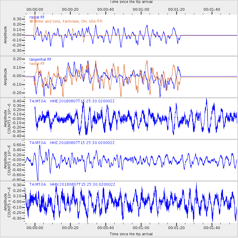
M53A WI Miller and Sons, Farmdale, OH, USA - Earthquake Result Viewer
*The percent match for this event was below the threshold and hence no stack was calculated.
| Earthquake location: |
Off East Coast Of Honshu, Japan |
| Earthquake latitude/longitude: |
37.9/144.1 |
| Earthquake time(UTC): |
2018/08/07 (219) 15:12:57 GMT |
| Earthquake Depth: |
12 km |
| Earthquake Magnitude: |
5.6 Mww |
| Earthquake Catalog/Contributor: |
NEIC PDE/us |
|
| Network: |
TA USArray Transportable Network (new EarthScope stations) |
| Station: |
M53A WI Miller and Sons, Farmdale, OH, USA |
| Lat/Lon: |
41.44 N/80.68 W |
| Elevation: |
334 m |
|
| Distance: |
91.1 deg |
| Az: |
31.958 deg |
| Baz: |
326.146 deg |
| Ray Param: |
$rayparam |
*The percent match for this event was below the threshold and hence was not used in the summary stack. |
|
| Radial Match: |
61.061756 % |
| Radial Bump: |
400 |
| Transverse Match: |
68.97887 % |
| Transverse Bump: |
400 |
| SOD ConfigId: |
13570011 |
| Insert Time: |
2019-04-30 17:53:47.977 +0000 |
| GWidth: |
2.5 |
| Max Bumps: |
400 |
| Tol: |
0.001 |
|
Signal To Noise
| Channel | StoN | STA | LTA |
| TA:M53A: :HHZ:20180807T15:25:30.020002Z | 3.1328669 | 3.5358E-7 | 1.1286148E-7 |
| TA:M53A: :HHN:20180807T15:25:30.020002Z | 0.66207814 | 9.462417E-8 | 1.4291994E-7 |
| TA:M53A: :HHE:20180807T15:25:30.020002Z | 1.9062809 | 1.7227667E-7 | 9.0373184E-8 |
| Arrivals |
| Ps | |
| PpPs | |
| PsPs/PpSs | |


